EAPS Displays on the third floor of the HAMP building
Third Floor
What's there?
The Solar System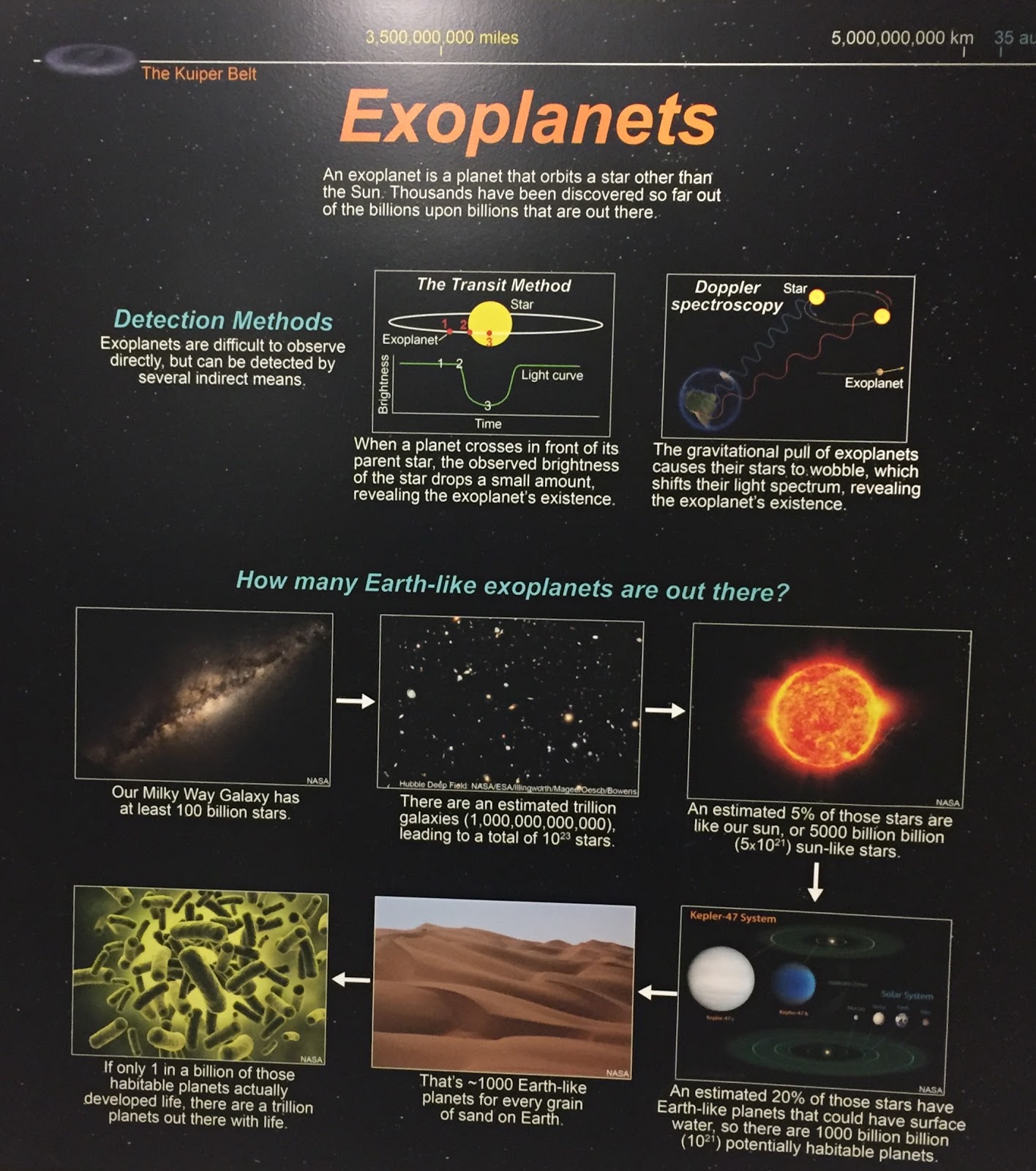
Exoplanets are planets that orbit a star that is not the Sun, and they are very difficult to observe directly. However, they can be detected when they cross in front of their parent star, thus dropping the observed brightness of that starby a small amount (Transit Method), or by the doppler spectroscopy (stars with exoplanets wobble due to the planets’ gravitational pull, shifting the star’s light spectrum). But how many Earth-like exoplanets are there? There are roughly 10^23 potentially habitable planets, and if only one planet in a billion actually produced life, there would be one trillion planets out there with living organisms. 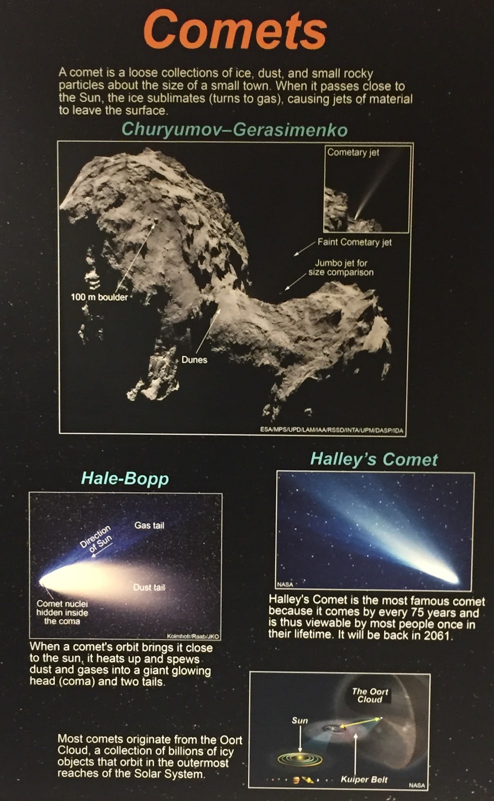
Many originating from the Oort Cloud, comets are defined as a loose group of dust, ice, and small rocky particles roughly the size of a small town. The famous tails comets sprout occur when a comet’s orbit brings it close to the sun, resulting in its consequential release of dust and gas. Halley's Comet passes by Earth every 75 years.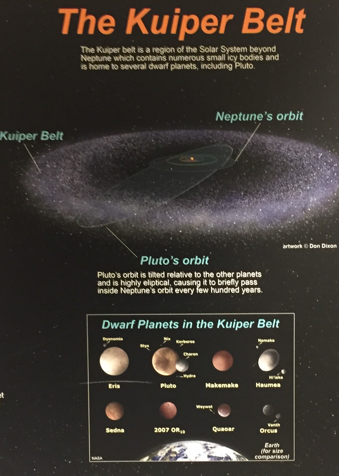
The Kuiper Belt is the home to the dwarf planets and other icy bodies. This area is the space beyond Neptune, and Pluto is a resident (though it will sometimes cross inside Neptune’s orbit every couple hundred years). 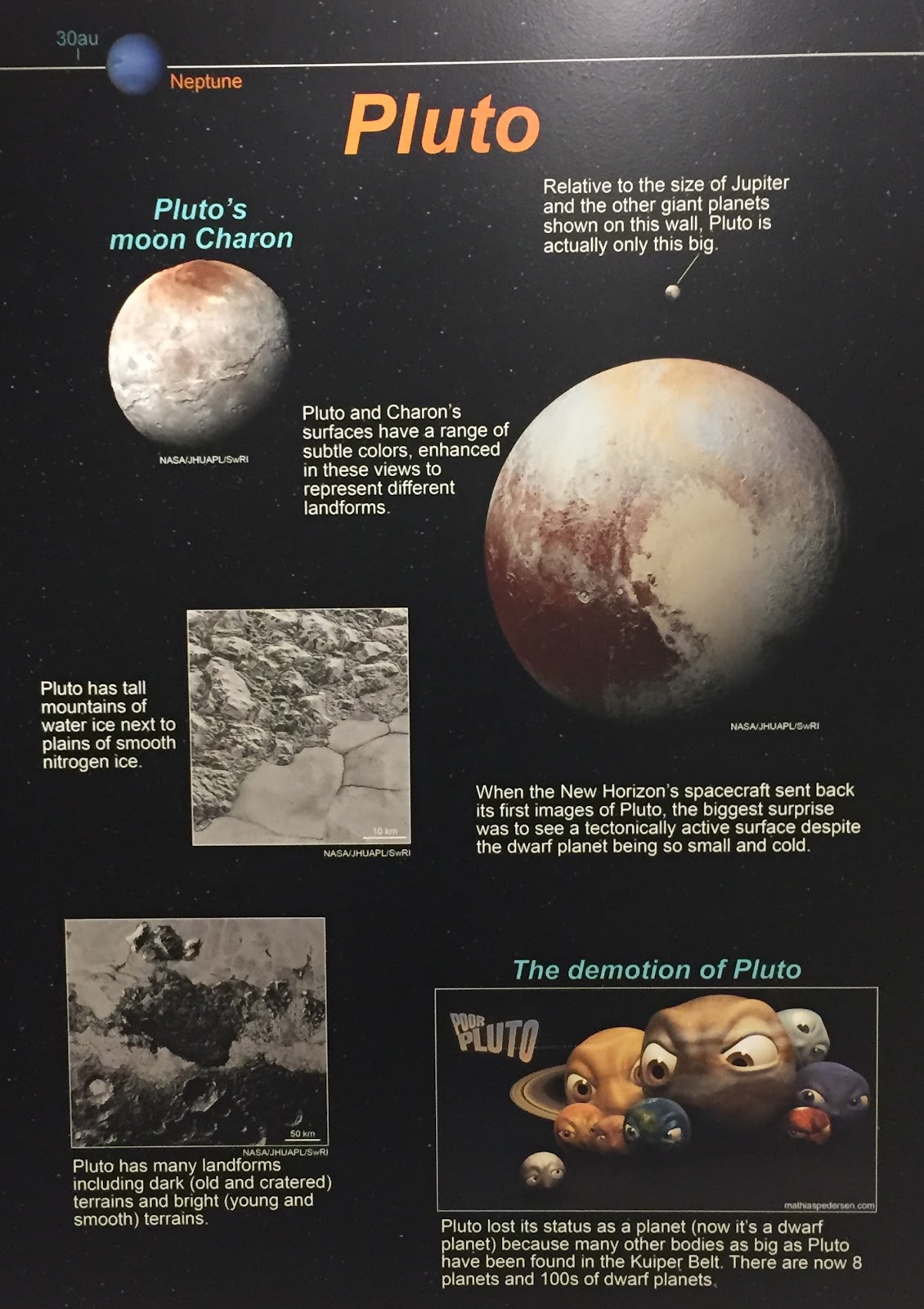
Once a planet, Pluto is now classified as one of the hundreds of dwarf planets in the solar system. Though it be just a dwarf planet, Pluto has a moon! This moon is called Charon. Pluto also has a terrain, made of tall mountains of water ice and plains of smooth nitrogen ice, along with other landforms. 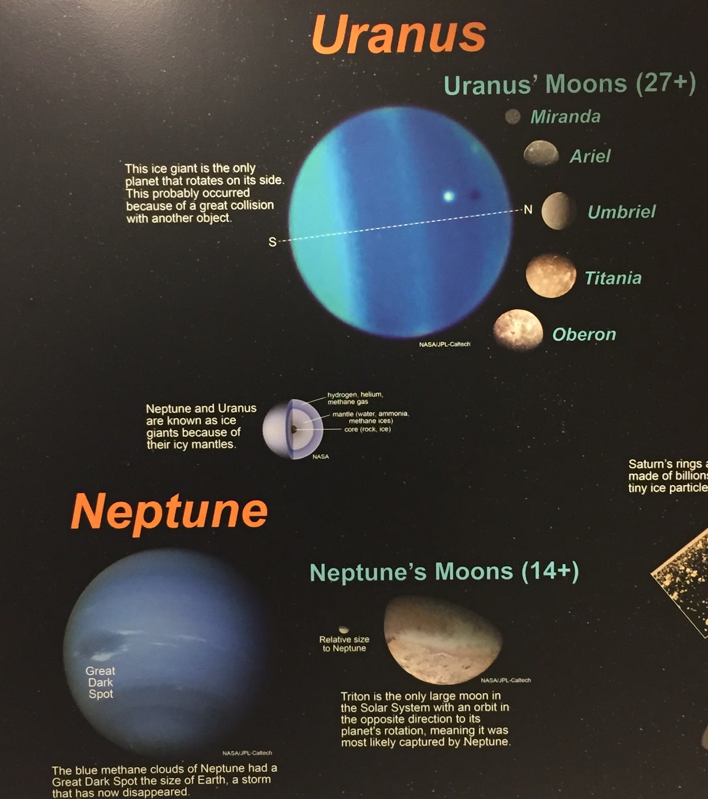
The two planets farthest from the Sun, Uranus and Neptune, are both ice giants (they have icy mantles) with many moons- at least twenty-seven and fourteen, respectively. In fact, one of Neptune’s moons, Triton, orbits opposite the direction of Neptune’s own rotation, the only large moon in the Solar System to do so! Contrary to how the rest of the planets in the Solar System rotate, Uranus rotates on its side. 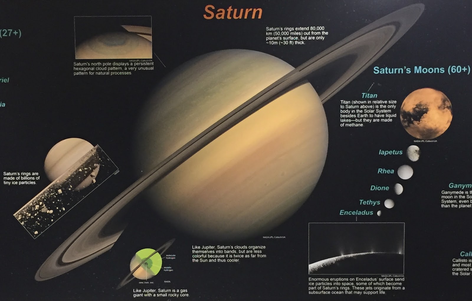
Saturn is a gas giant; this means that it has a small rocky core surrounded by gas. Saturn’s rings, however, are made of of billions of ice particles. Some of these ice particles come from eruptions on one of Saturn’s moons, Enceladus. The rings themselves, though, stretch about fifty-thousand miles from Saturn’s surface and are only roughly thirty feet thick. 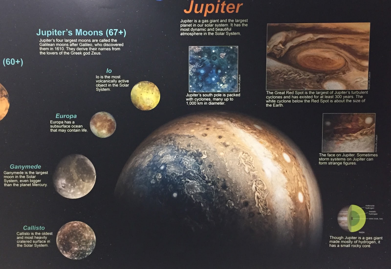
Jupiter is the largest planet in the Solar System and is one of the gas giants. Famous for its Great Red Spot, that particular cyclone has been alive for the past three hundred years. Jupiter’s south pole also has cyclones whirling around, but none of them are as large as the Great Red Spot. Off-planet, on one of Jupiter’s many moons, there is a possibility of life within Europa’s subsurface ocean!
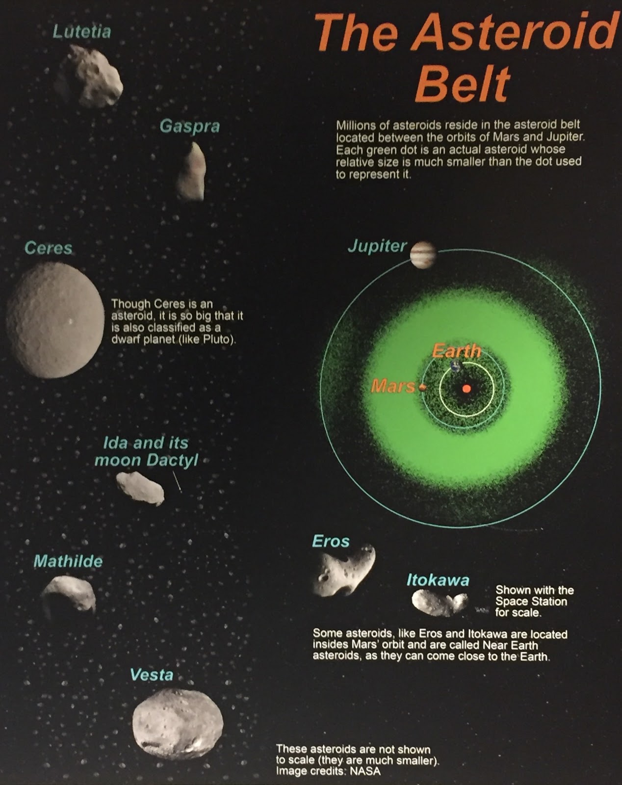
The Asteroid Belt is located between the orbits of Jupiter and Mars. In the photo, each green dot represents an asteroid (though they are smaller than depicted by the dots). Some asteroids do not reside between Mars and Jupiter, however- Eros and Itokawa are considered Near Earth asteroids because they are located inside Mars’ orbit.
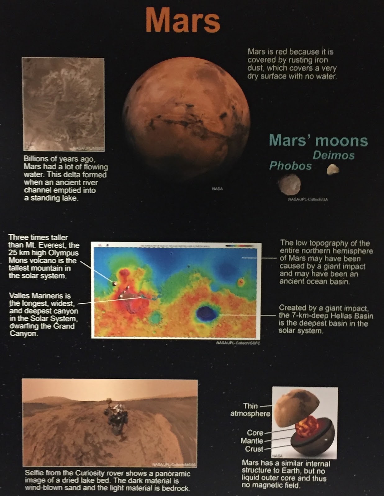
Mars, our Red Planet neighbor, holds many records in the Solar System- Mars has the tallest mountain, the deepest basin, and the deepest canyon. However, that is not why Mars is so famous. Mars gets its characteristic red color from the rusting iron dust on its surface. Mars also used to have water, many billions of years ago.
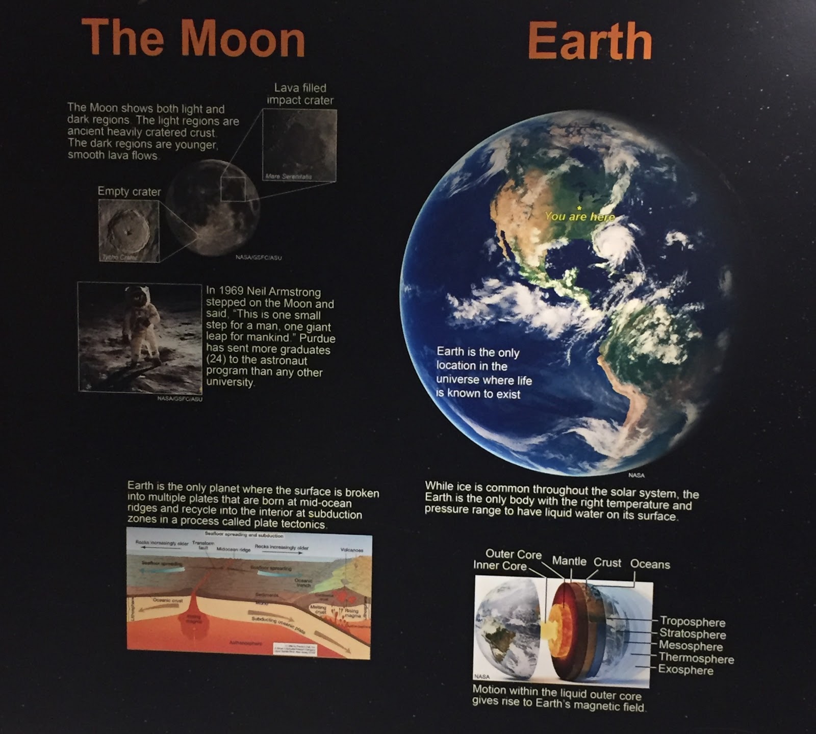
Earth, as far as science’s current knowledge is concerned, is the only location in the universe where life is one-hundred percent known to exist. Earth is also the only planet with both plate tectonics and liquid water in the solar system. Earth only has one satellite, the moon, and, in 1969, Purdue graduate Neil Armstrong became the first man to step foot on it.
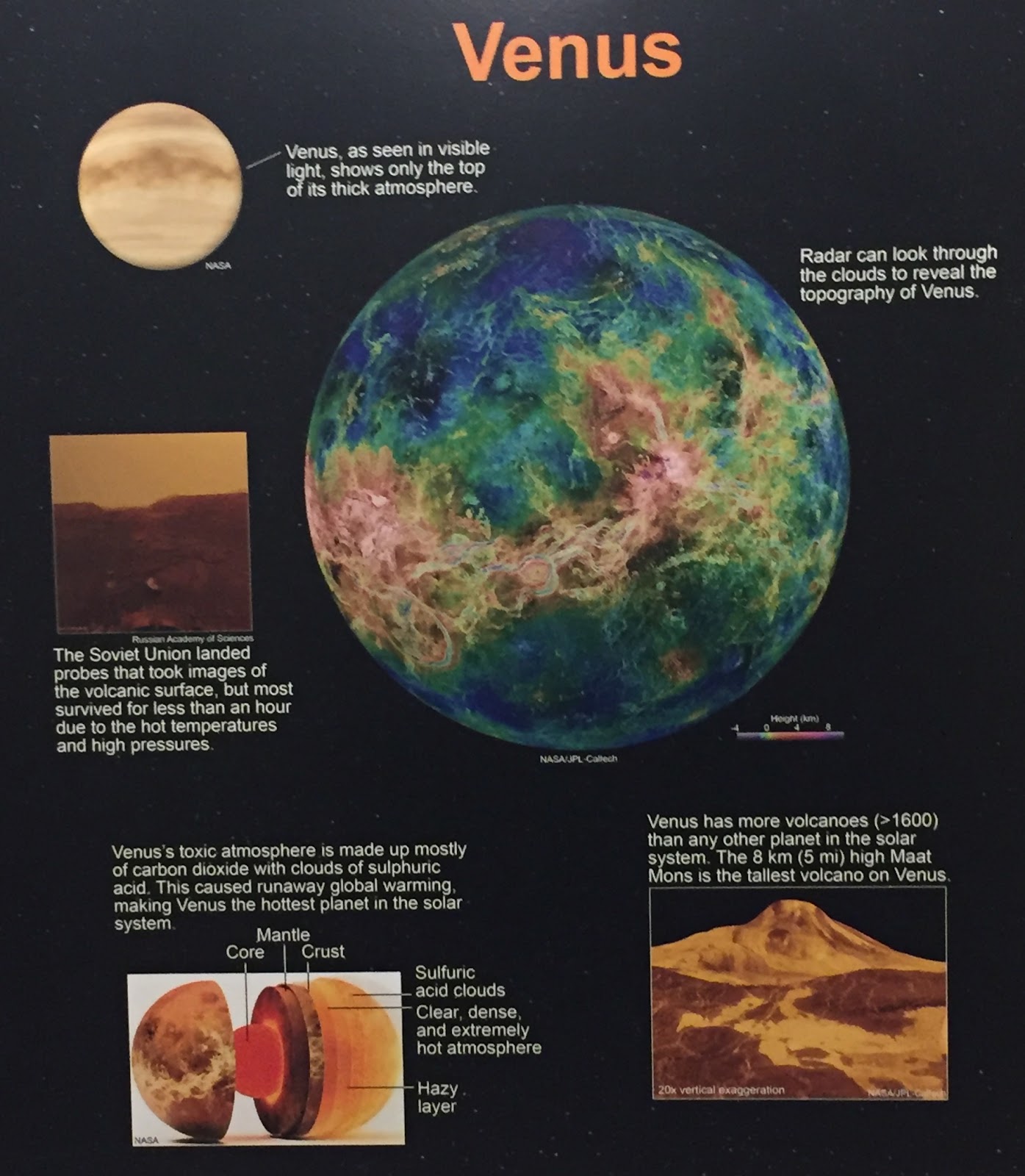
Venus is the hottest planet in the solar system. This is due to the fact that its atmosphere is composed of mainly carbon dioxide with sulphuric acid clouds, leading to rampant global warming. In fact, Venus is so hot that, when the Soviet Union landed probes there, the majority of them lasted less than an hour due to the combined effects of high pressure and extremely hot temperatures. Venus also has the most volcanoes in the Solar System.
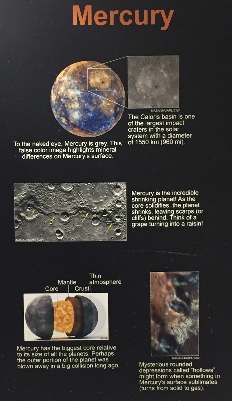
Mercury is the closest planet to the Sun. It also has the largest core relative to its size compared to all of the other planets in the Solar System. When this massive core is solidifying, however, Mercury actually shrinks, leaving cliffs, known as scarps, behind (similar to how a grape becomes a raisin). Outside of the scarps, Mercury is also mottled with hollows (rounded depressions). These hollows happen when something on the surfaces converts from solid to gas.
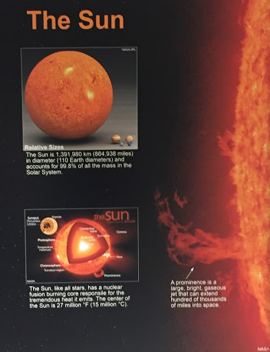
In the Solar System, the Sun accounts for 99.8% of all mass, and is roughly 864,938 miles in diameter. As such, the Sun is very large, and it is also extremely hot- at its core, the Sun is fifteen million degrees Celsius. Large, gaseous jets, known as prominence, can extend from the Sun’s surface to hundred of thousands of miles into space.
Geomorphology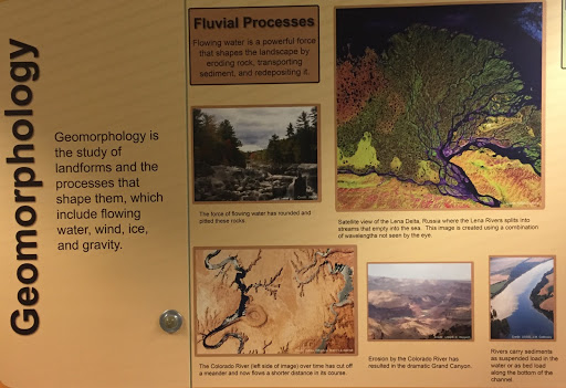
Geomorphology is the study of landforms and the processes that shape them. These process are wind, ice, gravity, and flowing water. With this in mind, flowing water is a very powerful force, creating large things such as the Grand Canyon (which was carved away by the Colorado River) or small things, like rounded stones on a riverbed. The use of flowing water is known as the Fluvial Processes.
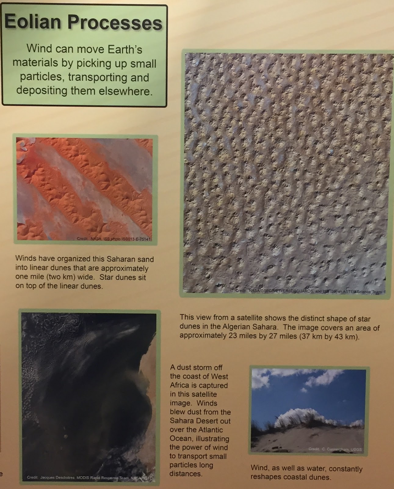
The Eolian Processes, or, the use of wind to change and create landforms, can do many beautiful things as well, such as create the star shaped dunes in the Algerian Sahara.
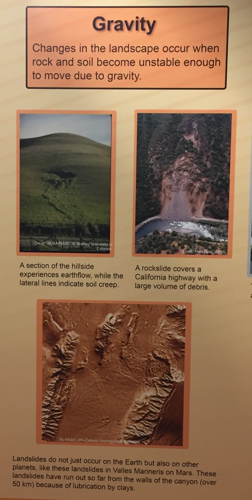
Sometimes, landscapes change because of gravity’s pull. Examples of this would be landslides and rockslides. Furthermore, landslides aren’t exclusive to Earth! There has been evidence of landslides on many other planets, such as in the Valles Marineris on Mars.
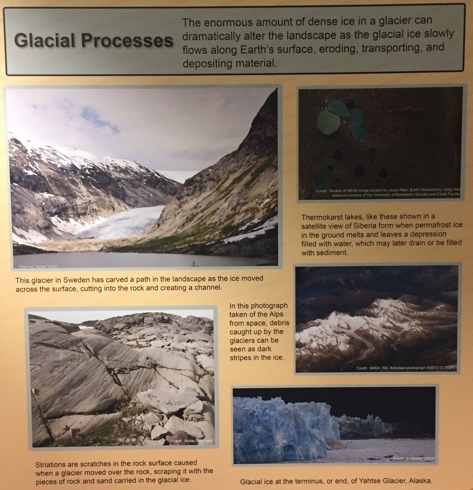
While some processes can cause relatively small changes in the planet’s landscapes (say, water smoothing out rocks on a riverbed), glacial processes can drastically change the way the landscape is due to their massive size and reach. Channels can be created, rock surfaces could be scratched (striations), and thermokarst lakes can form (these happen when permafrost ice in the ground melts and leaves a water-filled depression behind).
Plate tectonics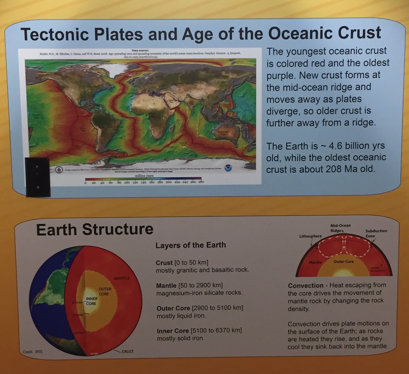
The top photo depicts the ages of the oceanic crusts on Earth, the oldest depicted in purple, the youngest in red. New ocean crust is created at the mid-ocean ridge and moves away as the plates separate. The current oldest oceanic crust is roughly 208 Ma old, compared to the Earth’s 4.6 billion years of age. The oceanic crust is not what makes up the entire planet, however- Earth’s structure is as follows: an inner core (composed of mostly solid iron), an outer core (made up of liquid iron), a mantle (magnesium-iron silicate rocks), and a crust (granitic and basaltic rock). 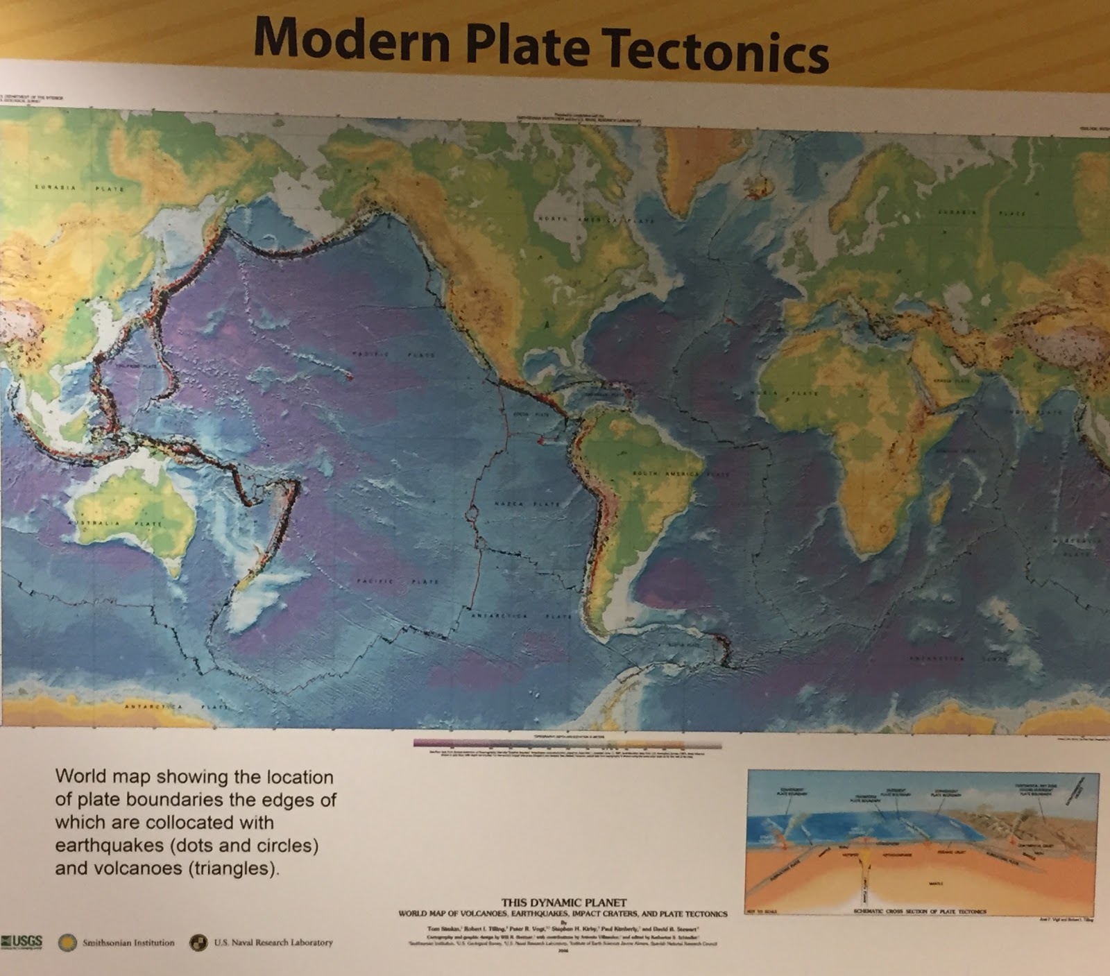
This depicts the location of Earth’s volcanoes, earthquakes, and plate boundaries.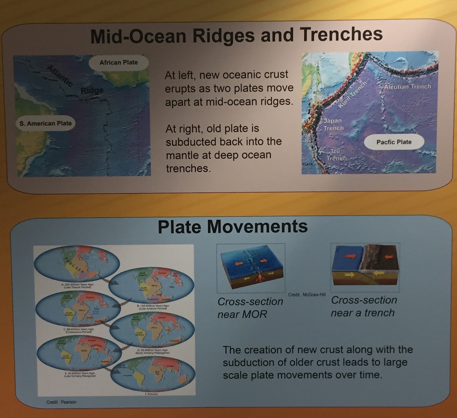
In the top photo, on the right, an old plate is subducted back into the mantle at deep ocean trenches. On the left, new oceanic crust is created as two plates move apart at mid-ocean ridges. It is this creation and subduction that leads to large scale plate movements over time (for example, Pangaea slowly making its way into what Earth looks like today).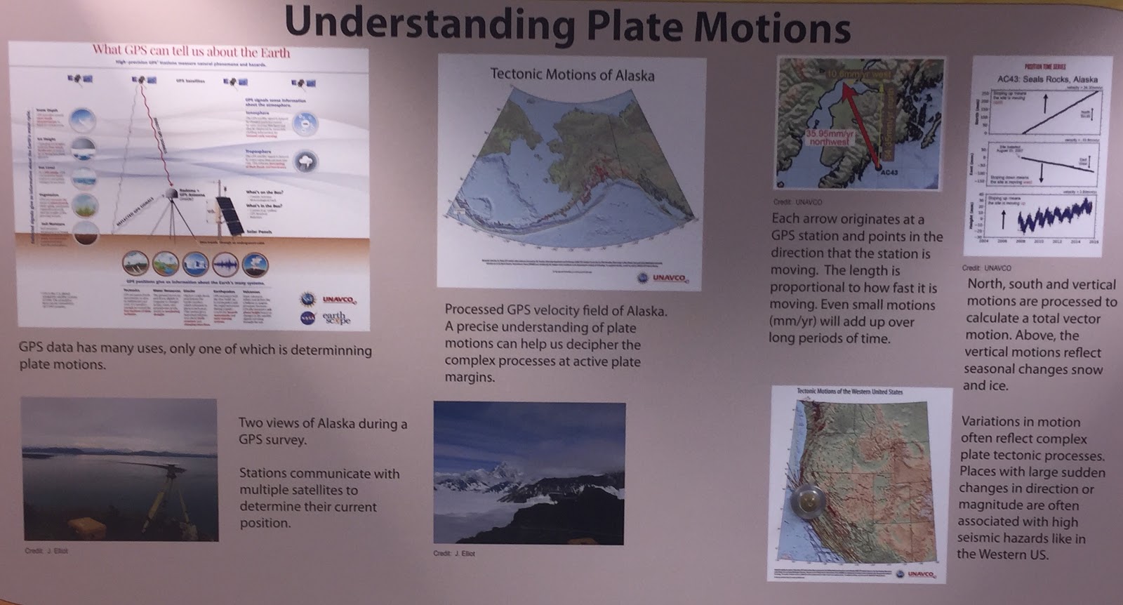
GPS can be used to determine Earth’s plate movements! This portion of the EAPS wrap depicts how scientists used GPS to determine plate movement in Alaska- even small motions (mm/yr) can add up over time and contribute to large land changes. 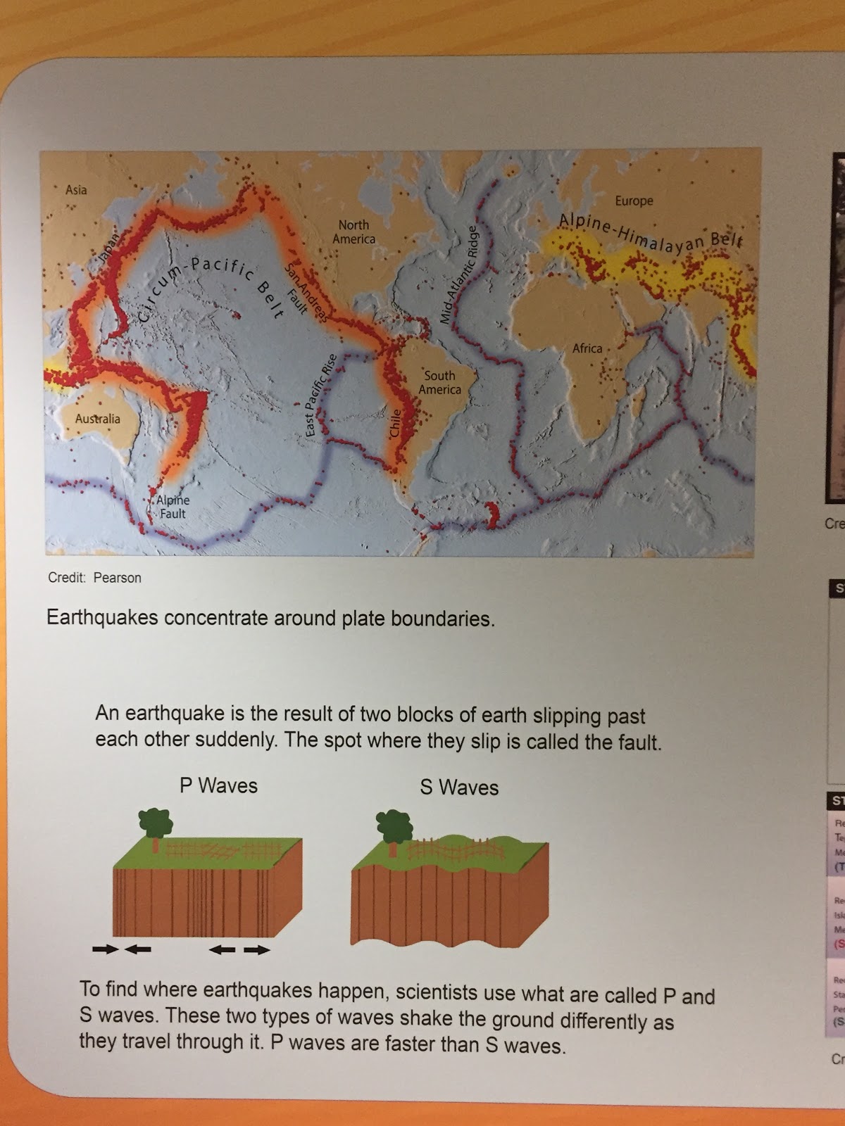
One of the Earth’s most devastating natural disasters, earthquakes happen when two blocks of earth suddenly slide past each other (the spot where this happens is dubbed the fault). S and P waves are used to determine where these earthquakes happen, and, generally speaking, earthquakes are located around plate boundaries. 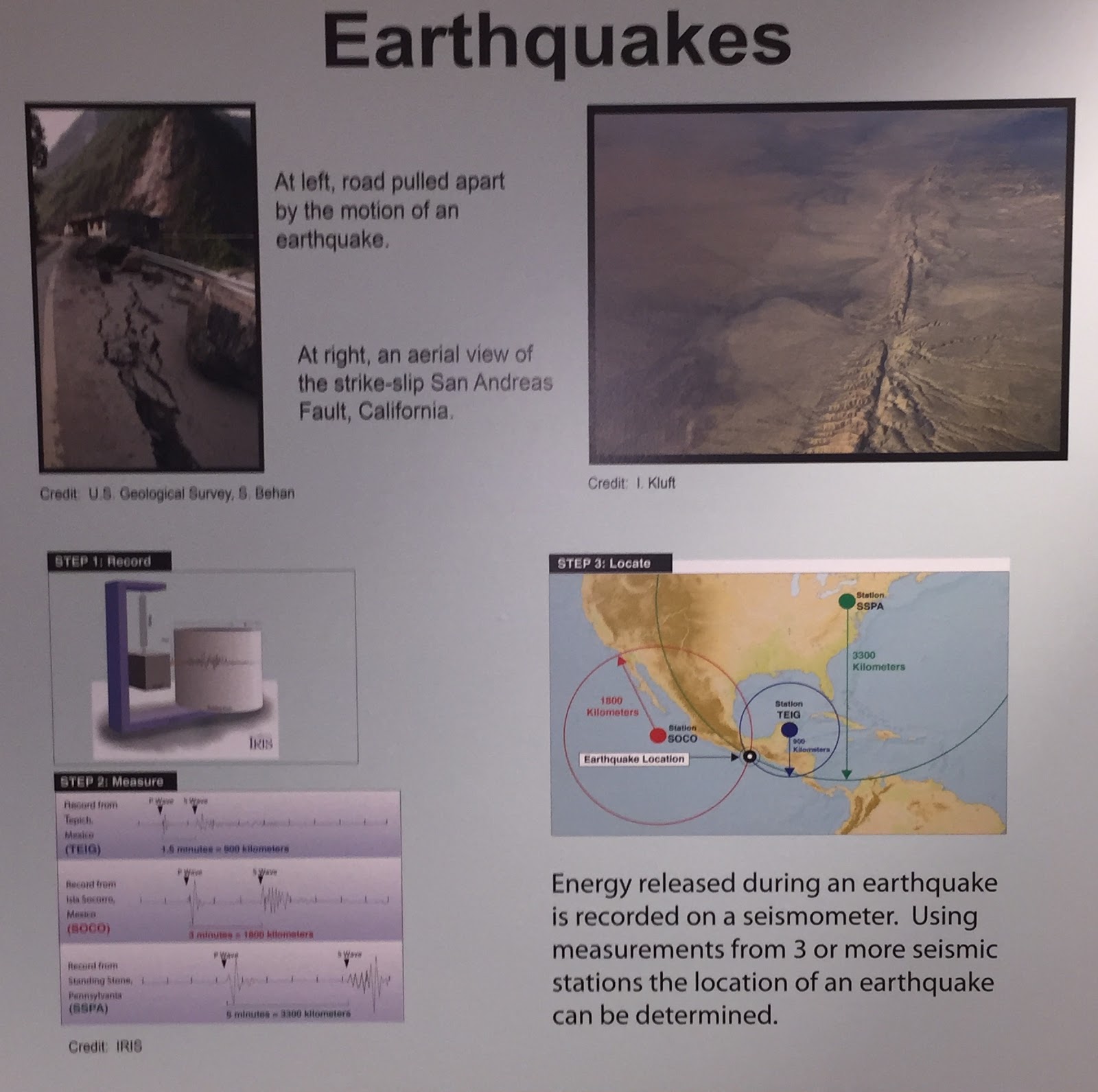
As anyone who lives on the West Coast can probably tell you, earthquakes are potentially devastating forces of nature. They can tear apart roads, level buildings, or simply cause a slight tremor. Where these earthquakes originate, though, are determined by using measurements from three or more seismic stations. 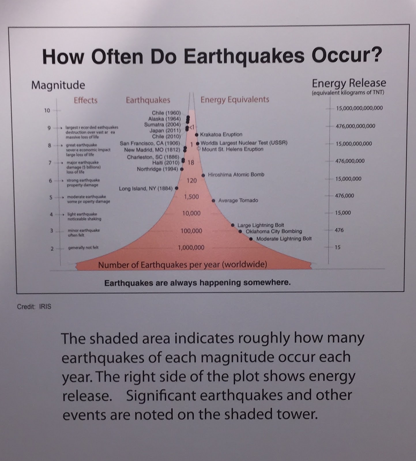
Luckily, as destructive as earthquakes can be, the greater majority of earthquakes (roughly 1,000,000 globally per year) have an intensity of two or less and thus, are generally not felt. The strongest earthquakes, those with an intensity of eight or more, happen, globally once per year (or even statistically less than that). However rare these earthquakes are though, they can be extremely destructive and take many, many lives. To paint a picture as to how much energy is released during an earthquake, the San Francisco earthquake of 1906 released roughly the same amount of energy that Mount St. Helens did when it erupted. 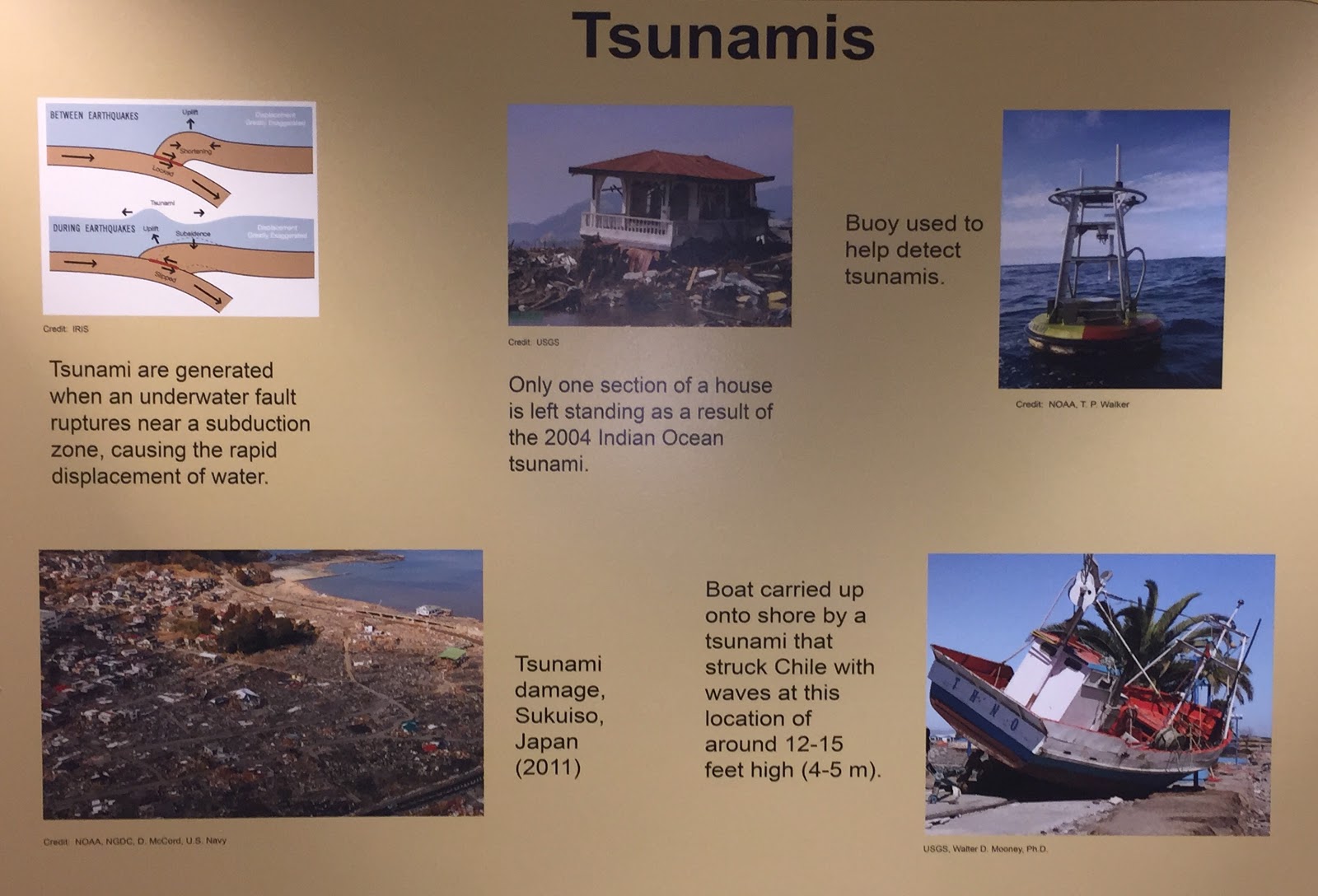
Tsunamis are often a result of when an underwater fault ruptures near a subduction zone. When this happens, water is displaced, and a tsunami can develop. Tsunamis are no joking matter- they can level entire towns (as seen from the tsunami that hit Sukuiso, Japan in 2011) and drag entire boats from the ocean and deposit them on land. Tsunamis are often detected from various buoys placed in the sea. 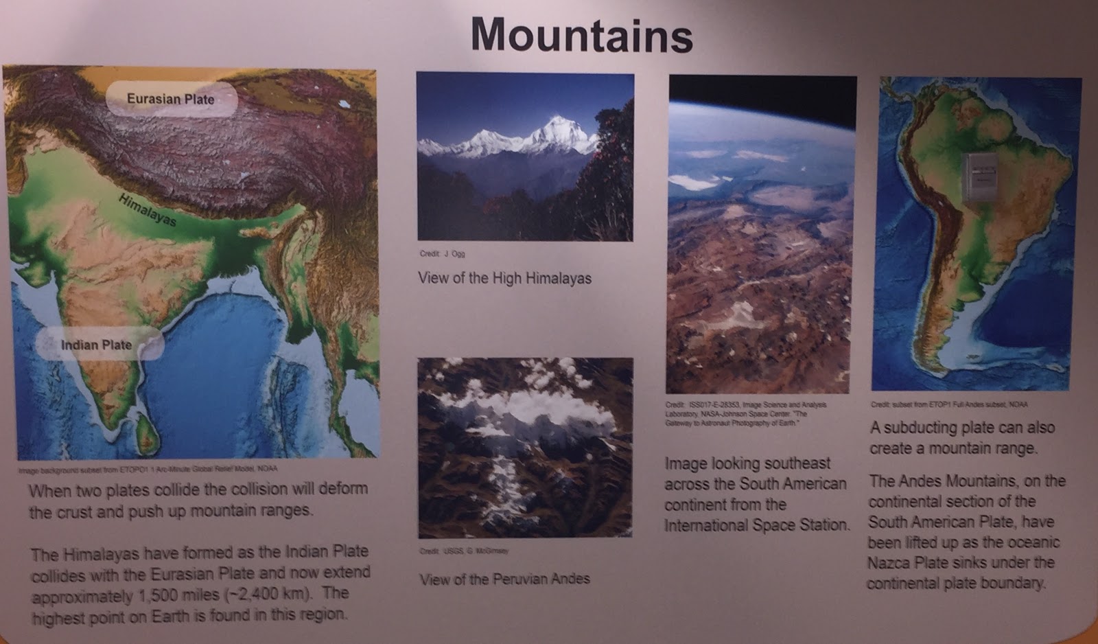
Mountain ranges can form one of two ways- from a subducting plate (an example being the Andes Mountains) or when two plates collide, deforming the crust and pushing up mountain ranges (such as the Himalayas). The highest point on Earth, Mt. Everest, is found in the latter.
Volcanoes
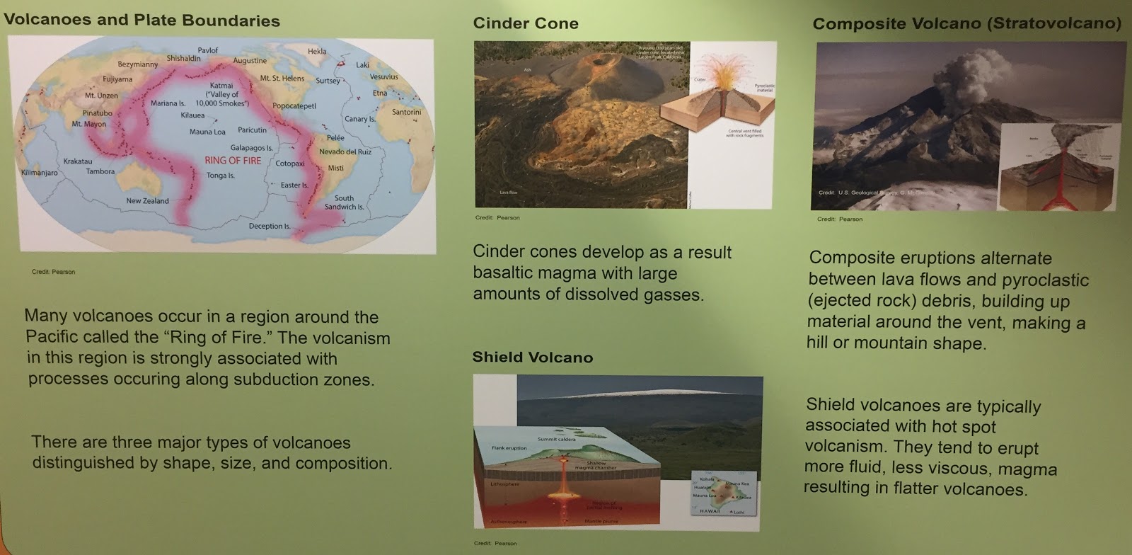
As depicted, there are volcanoes around the entire globe, most of which located within the Pacific, dubbed the “Ring of Fire”. There is not just one type of volcano, however. In fact, there are three types- composite (stratovolcano), shield, and cinder cone. Composite volcanoes are associated with a mountain shape, shield volcanoes are generally very flat, and the cinder volcanoes, though not having a characteristic appearance, do form due to dissolved gasses and basaltic magma. 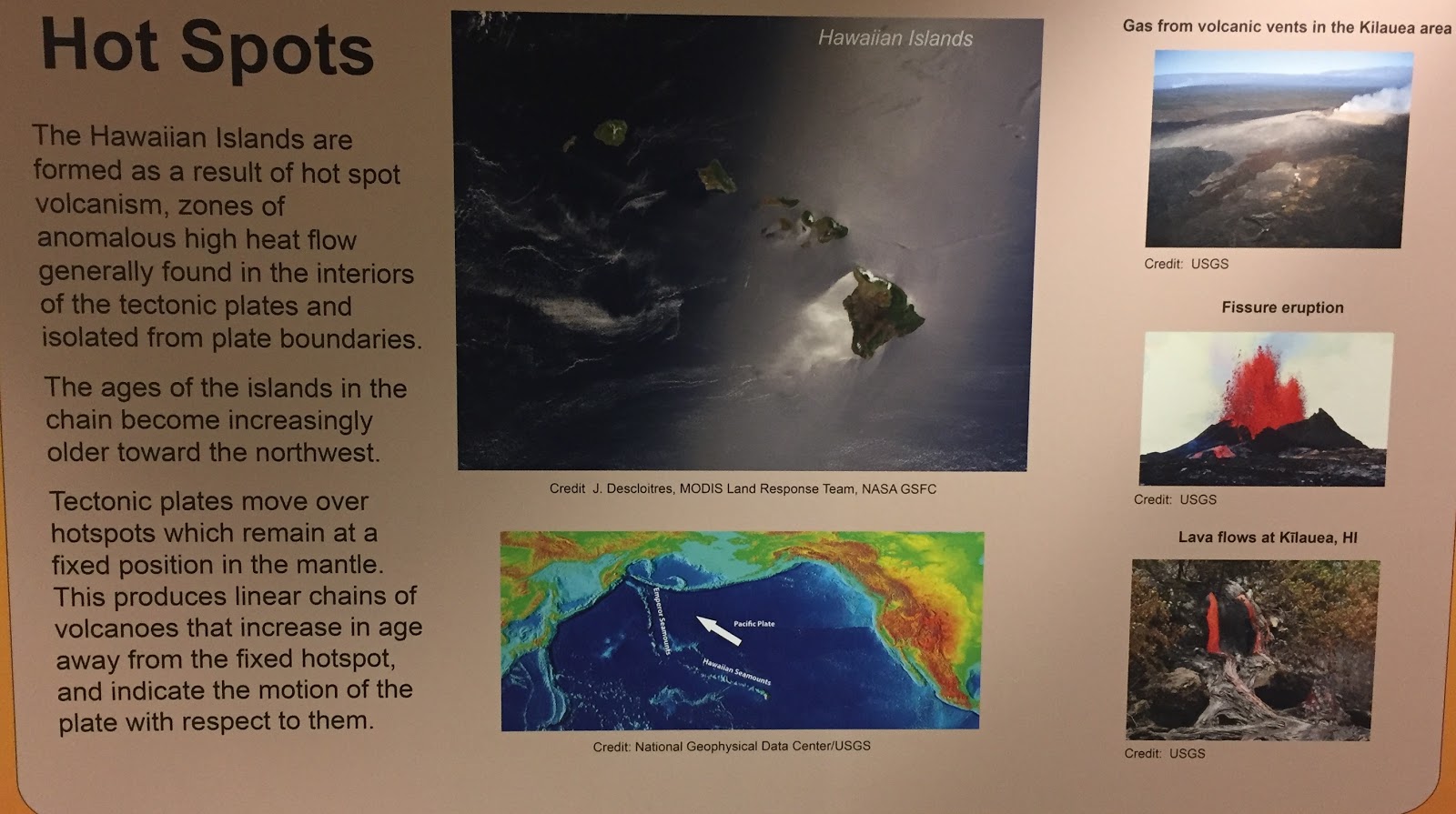
Hot spots are areas of abnormally high heat flow. When tectonic plates move over these spots, linear chains of volcanoes are created. The farther the volcano is from the fixed hotspot, the older it is. The Hawaiian Islands are an example of this phenomena, and, as a result of the aforementioned, the youngest volcano would be the main island, Hawaii.
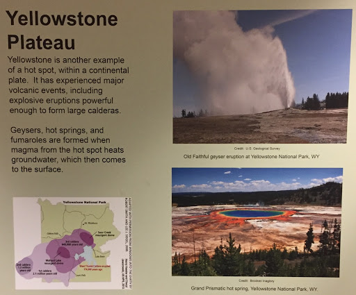
Hot spots aren’t just located in the ocean, however. For instance, Yellowstone is a prime example of a hot spot within a continental plate! The famous geysers, hot springs, and fumaroles located within the park are formed when the groundwater gets heated by the hot spot’s magma and comes to the surface.
Hydrogeology
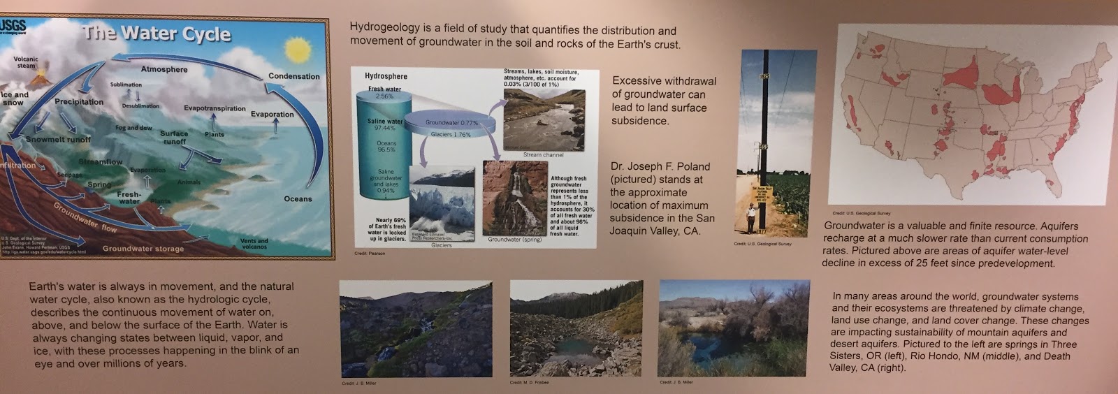
Water is everywhere; water is needed to sustain life, and Earth’s water is constantly moving through the various stages of the hydrologic cycle (natural water cycle). With saline water taking up 97.44% of all water in the hydrosphere, fresh water takes up the remaining 2.56%. Groundwater, on the other hand, only takes up 0.77% of all the water in the hydrosphere, but, despite its size, groundwater is extremely important! However, groundwater systems and their ecosystems are threatened globally because of the effects of land cover change, climate change, and land use change.
Indiana's Glacial Landscapes
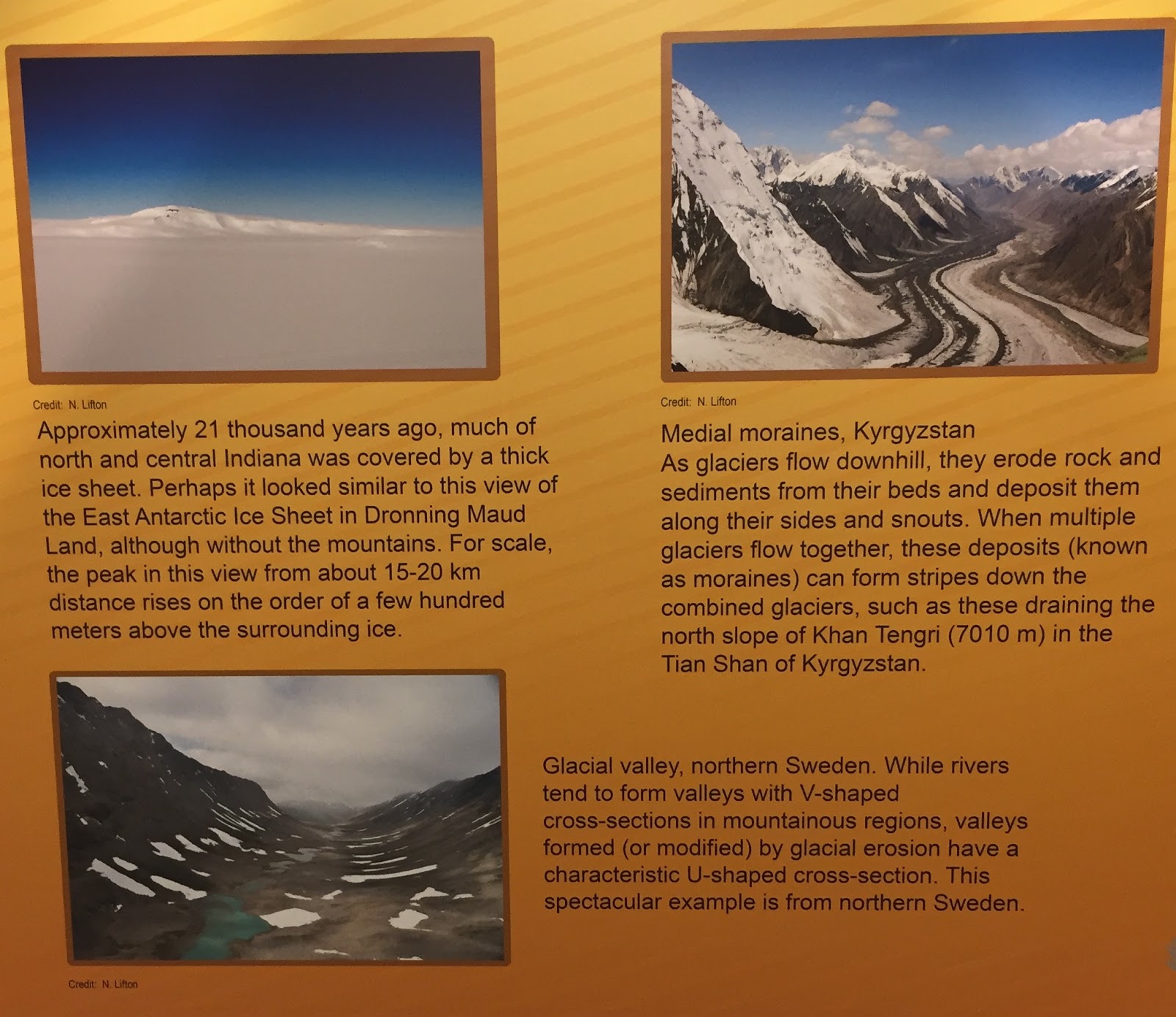
When people picture Indiana, they think of flat plains and open fields as far as the eye can see. However, twenty-one thousand years ago, this was not the case as north and central Indiana was slicked over by a massive ice sheet! Some places around the globe still see the effects of glaciers on their lands- they might have u-shaped valleys (a shape signature to glacial erosion) or striped moraines (eroded rock and sediments deposited along the sides and snouts of glaciers).
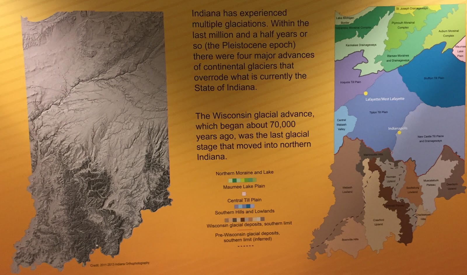
Indiana has experienced many glaciations in its lifetime, the most recent one being the Wisconsin glacial advance which started roughly 70,000 years ago. Overall, there have been four major continental glaciers advancements in Indiana within the past million and a half years.
Biogeochemistry
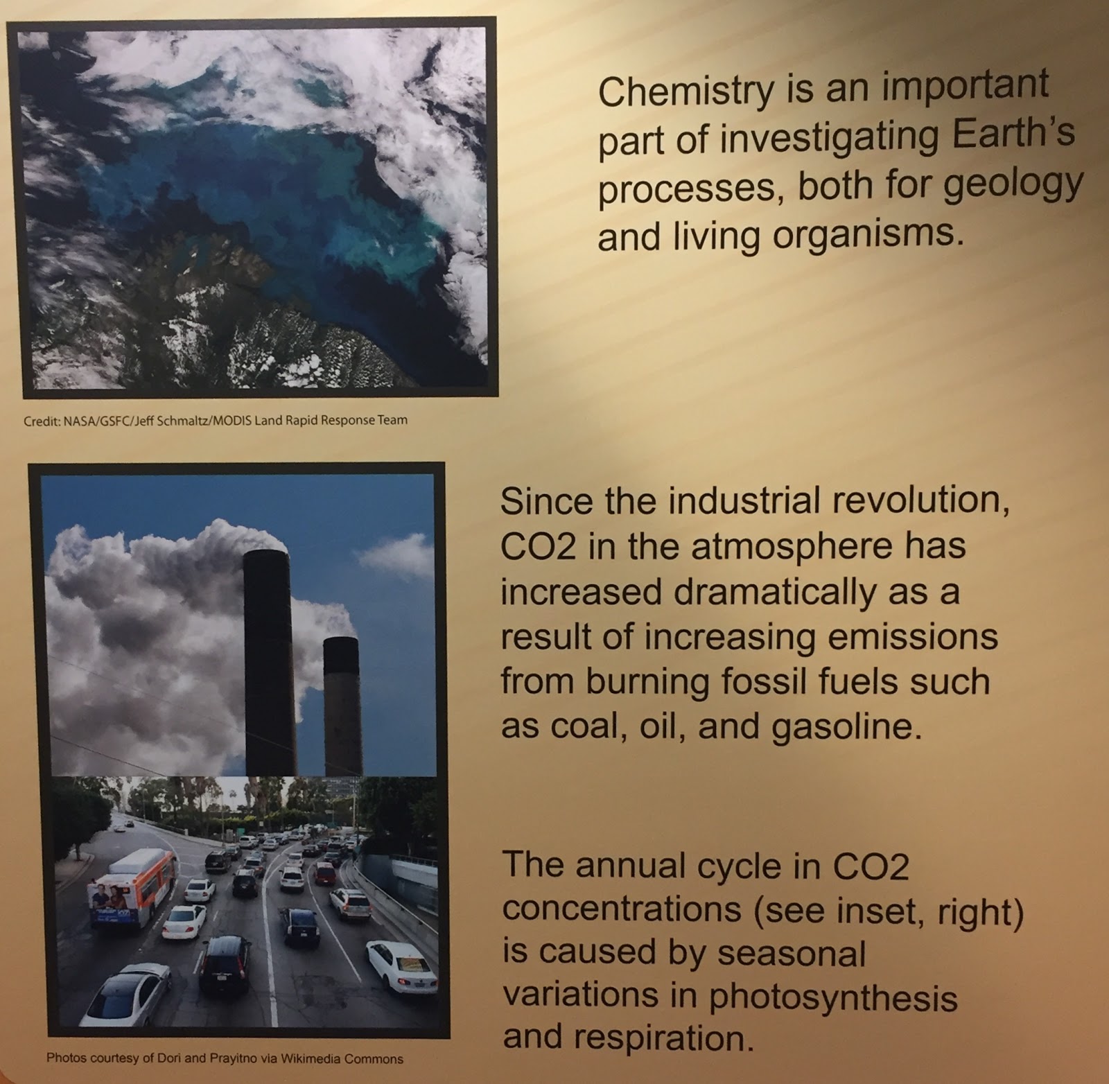
Carbon dioxide levels are increasing at alarming rates. Some reasons why the carbon dioxide levels are growing are due to the burning of coal, oil, and gasoline.
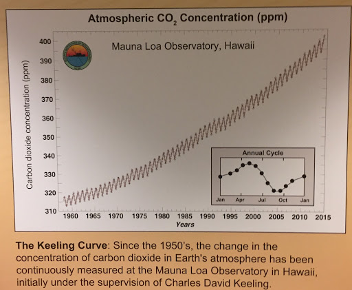
At the Mauna Loa Observatory in Hawaii, the annual amount of carbon dioxide concentration in the atmosphere is recorded. This data has been collected since the 1950’s and compiled into the graph seen above, showing a steady, yet steep, increase in the annual levels of carbon dioxide.
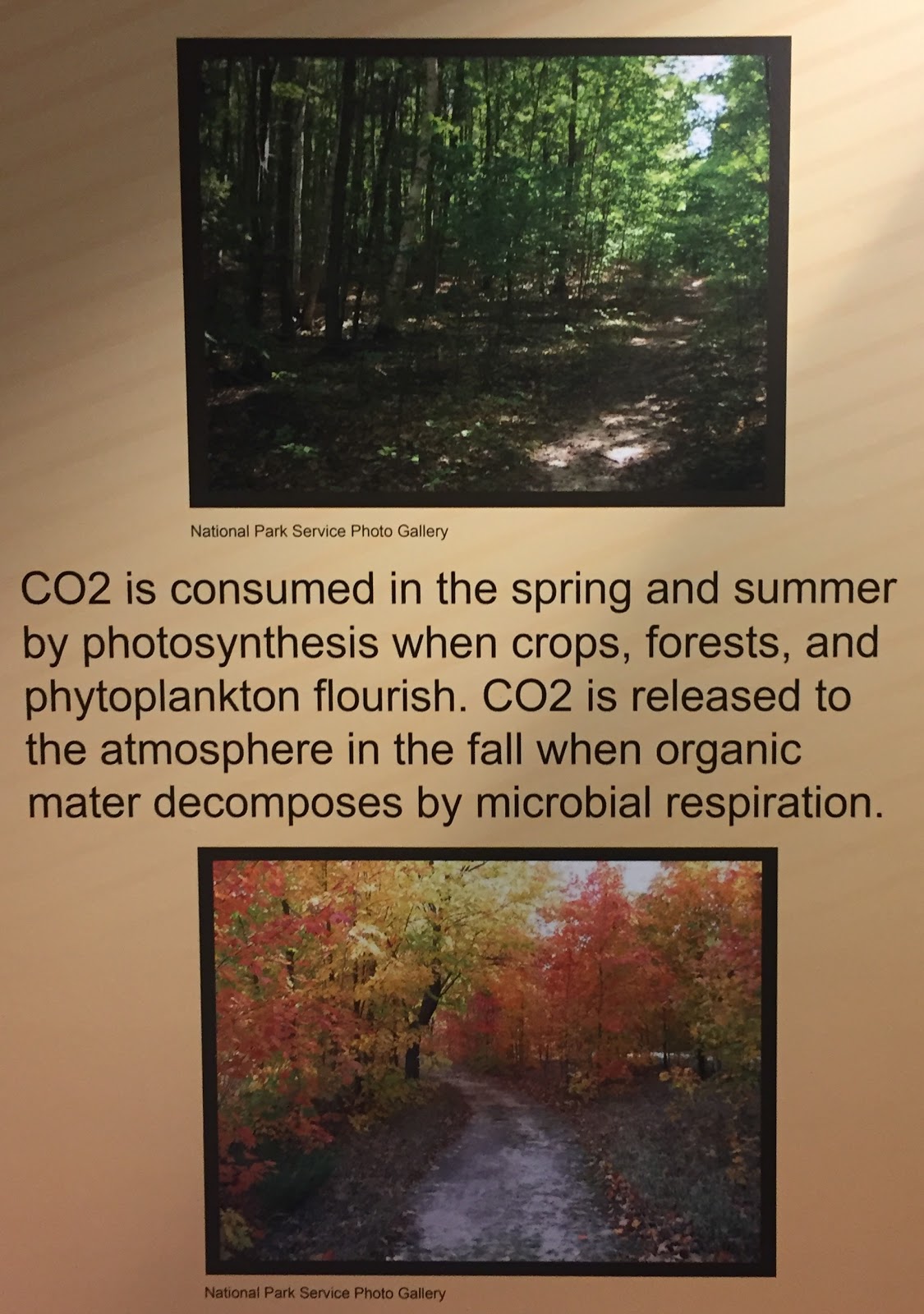
Carbon dioxide is released into the atmosphere during the fall due to the decomposition of organic matter. On the flip side, carbon dioxide is absorbed from the atmosphere during the spring and summer seasons because of the thriving plant-life’s photosynthesis processes.