Purdue scientist leads NASA airborne campaign to help map a changing Earth
10-16-2026
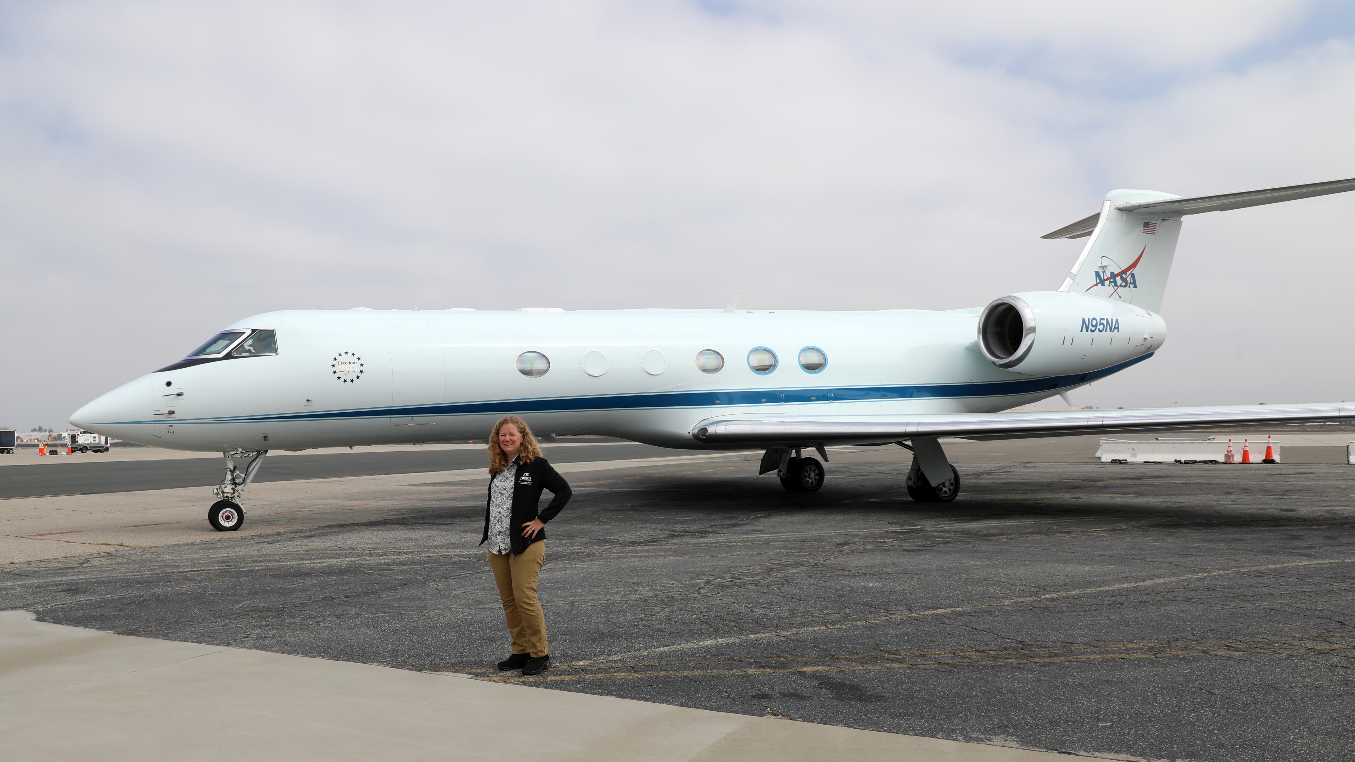
Andrea Donnellan, professor in Purdue University's Department of Earth, Atmospheric, and Planetary Sciences, stands in front of the NASA Gulfstream V used during the 2026 ASCENT campaign. (Photo credit/Andrea Donnellan)
Before scientists can develop a new way to map Earth from space, they first have to prove the pieces can work together from the air.
That was the goal of NASA's Airborne Surface, Cryosphere, Ecosystem, and Nearshore Topography, or ASCENT, campaign, which sent two NASA aircraft over California in late June. The flights collected measurements of forests, mountains, faults, snow, lakes, coastlines and other landscapes to help researchers test technologies that could one day measure Earth's changing surface from space.
Andrea Donnellan, professor in Purdue University's Department of Earth, Atmospheric, and Planetary Sciences, or EAPS, leads NASA's Surface Topography and Vegetation, or STV, study, of which ASCENT is a part. Donnellan coordinated the campaign with the STV team, the STV technology co-lead Craig Glennie from the University of Houston, Yunling Lou at NASA's Jet Propulsion Laboratory and Michelle Hofton at NASA's Goddard Space Flight Center. Purdue PhD student Anthony Wendel also participated in the campaign as an operator of the SAR-Fusion instrument alongside JPL operators.
The ASCENT airborne campaign is providing test data researchers can use to develop the technologies and algorithms needed for a future spaceborne observing system. One of the main goals is to determine how measurements from radar, lidar and stereoimaging can be combined to distinguish vegetation structure from bare ground topography, separate shallow water from underlying terrain and produce a more complete picture of Earth's surface.
“No single instrument can measure everything we want to know about Earth's surface structure,” Donnellan said. “The point of ASCENT is to figure out how these different instruments can work together, because ultimately that is what we would want to do from space.”
The campaign used two aircraft carrying complementary instruments. A NASA Gulfstream V carried the Laser Vegetation Imaging Sensor, or LVIS, and Donnellan's QUAKES stereoimaging instrument. A Gulfstream III carried NASA's UAVSAR radar instrument and SAR-Fusion, another stereoimaging instrument led by Donnellan.
“We're using several different technologies to look at the same landscape and tell us different parts of the story. The real power comes when we can combine those views into a comprehensive product of what is happening at Earth's surface structure,” Donnellan said.
Radar, lidar and stereoimaging each observe the surface differently. Together, they can provide information about vegetation structure, surface elevation and the shape of the land, giving scientists several views of the same landscape.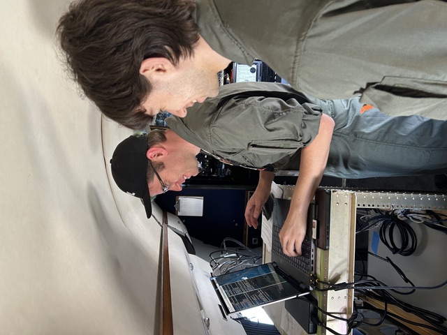
Purdue graduate student Anthony Wendel works with the SAR-Fusion instrument aboard the NASA Gulfstream III during the ASCENT campaign. (Photo Courtesy of Ian Elkin/NASA)
California provided a useful proving ground because the campaign could sample different environments within one region. Flight targets included coastlines and even Mars analogs. The campaign also collected measurements over the San Andreas Fault and several areas where previous data were available for comparison.
For Donnellan, the campaign builds on a career focused on using remote sensing to better understand earthquakes and changes at Earth's surface. Her research uses measurements of crustal deformation and topography to improve understanding of earthquake hazards.
The broader STV effort expands that approach across several parts of the Earth system. Detailed and repeated measurements of the surface could help scientists study earthquakes, landslides, volcanoes and coastal change while also monitoring forests, glaciers, snow and water resources.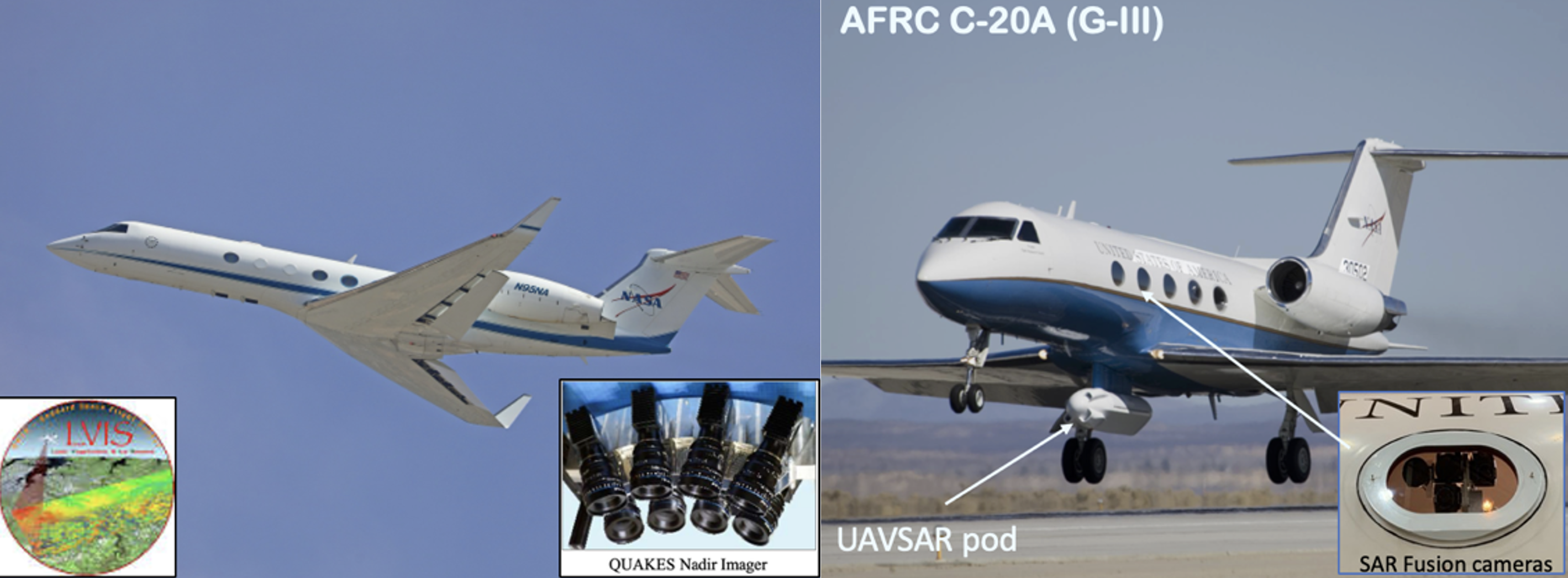
Photos of the two NASA aircraft with labels of instruments on each. The plane on the left uses LVIS (lidar) and QUAKES (VIS stereoimager). The plane on the right uses UAVSAR (L-band SAR) and SAR-Fusion (vis/SWIR Stereoimager). (Photo courtesy of NASA and Andrea Donnellan)
Early results from the California flights already show how each instrument adds a different piece of the puzzle. UAVSAR can pick up changes in vegetation, while QUAKES images and LVIS can be combined to build detailed 3D maps of the ground. The campaign also gathered data over areas burned by the Caldor Fire. LVIS and QUAKES collected downward-looking data, while SAR-Fusion captured side-view images that align with the side-looking UAVSAR data.
The California flights are just the first step in a larger series of ASCENT tests in different parts of the world. Next up are planned campaigns along the East Coast, where scientists will study forests, wetlands and shallow coastal waters, and in Central America, where they'll face the added complexity of dense tropical forests and volcanic landscapes.
Each new flight helps the team get closer to figuring out how all these tools would work together from space. "The aircraft data let us mature the technology and science for a spaceborne observing system," Donnellan said. "Space is where we can ultimately use it to study the whole planet."
The ASCENT campaign is a NASA project.
About the Department of Earth, Atmospheric, and Planetary Sciences at Purdue University
The Department of Earth, Atmospheric, and Planetary Sciences (EAPS) combines four of Purdue's most interdisciplinary programs: geology and geophysics, environmental geosciences, atmospheric sciences, and planetary sciences. EAPS conducts world-class research; educates undergraduate and graduate students; and provides our college, university, state and country with the information necessary to understand the world and universe around us. Our research is globally recognized; our students are highly valued by graduate schools and employers; and our alumni continue to make significant contributions in academia, industry, and federal and state government.
Written by: David Siple, communications specialist, Department of Earth, Atmospheric, and Planetary Sciences at Purdue University
Contributors: Andrea Donnellan, department head and professor, Department of Earth, Atmospheric, and Planetary Sciences at Purdue University; Anthony Wendel, PhD student in geology and geophysics, Department of Earth, Atmospheric, and Planetary Sciences at Purdue University.