Radar brings Moon landslides out of the shadows
08-10-2026
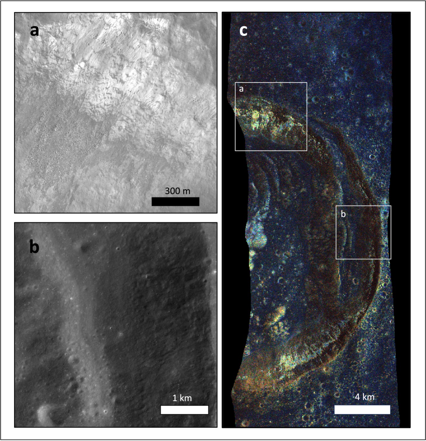
Landslides happen on the Moon, too! Without rain, wind or rivers, the lunar surface may seem frozen in time. But gravity still pulls rocks, dust and debris downhill, shaping the surface through landslides, boulder falls, debris flows, talus slopes and surface slumping. Scientists refer to this movement as mass wasting.
A new Purdue University-led study shows those disturbed areas can leave a recognizable signature in radar data, giving researchers another way to map how the Moon changes and how future missions might plan for safe landings and surface travel.
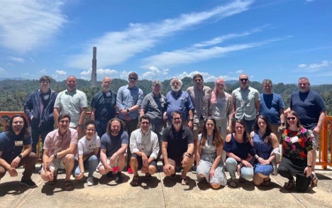
Mini-RF team at the Arecibo Observatory, Puerto Rico. May 2023. Purdue doctoral candidate Santa Lucía Pérez-Cortés is third from left in the bottom row and Purdue associate professor Ali Bramson is furthest right in the bottom row. (Photo provided by G. W. Patterson)
The study, led by Santa Lucía Pérez-Cortés, a doctoral candidate in Purdue University's Department of Earth, Atmospheric, and Planetary Sciences, was published in the Journal of Geophysical Research: Planets. Pérez-Cortés works with Ali Bramson, associate professor of EAPS and principal investigator of Purdue's Subsurface Planetary Investigations with Radar and AnaLogs Lab, known as the SPIRAL Lab.
The paper, "Characterization of Mass Wasting Events on Lunar Maria Using Mini-RF Radar Observations," used data from the Miniature Radio Frequency, or Mini-RF, instrument onboard NASA's Lunar Reconnaissance Orbiter (LRO) spacecraft. Pérez-Cortés mapped mass wasting features in a region of the Moon known as the “maria,” which are vast plains of basalts from ancient volcanic eruptions — the dark patches you see when you look up at the Moon. She built an inventory of those landslide-like features, classified them by type, and analyzed how they appeared in different radar products.
Bramson is a co-investigator on the NASA LRO team behind the Mini-RF radar system, which has been operating at the Moon since 2009. That connection helped make the project possible, linking the Purdue-led study with the mission expertise, radar data and broader science team to help interpret the Moon's surface in a new way. The work reflects a collaboration among Purdue researchers, Mini-RF science team members, NASA mission personnel, and scientists from several institutions.
That work is part of a broader research portfolio in Bramson’s SPIRAL Lab using radar and other remote-sensing techniques to understand planetary surfaces and what lies beneath them. A recent Purdue News feature highlighted another side of that research, following Bramson’s fieldwork on Earth to study geologic analogs for the Moon and Mars and the resources and hazards future explorers may encounter.
"We observed that landslide features on the Moon leave a recognizable 'fingerprint' in radar data," Pérez-Cortés said. "This opens the possibility of using radar not only to study how the Moon evolves through time, but also to help assess hazards for future robotic and human missions."
Traditionally, scientists identify the scars from mass wasting events by studying visible images of the surface and tracing where rocks and debris have appeared to move downhill. That approach can work well when the lighting is clear. But it becomes harder in places where cameras struggle, including regions near the lunar poles that are permanently shadowed.
Radar offers another view. Instead of depending on sunlight, radar sends radio waves toward the surface and measures how they scatter back. When rocks and debris become unstable and tumble downhill, they can roughen the surface and shallow subsurface. That roughness changes the radar echo, making some mass wasting features stand out from the surrounding terrain.
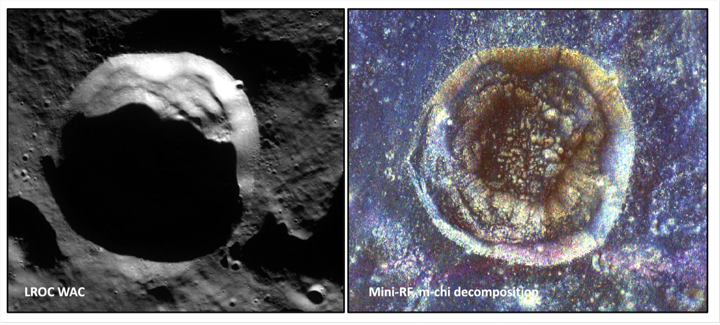
View of Wiechert E crater in the South Pole of the Moon, as seen in images taken by a camera (left) and by the Mini-RF radar system (right). (Photo provided by S. L. Pérez-Cortés. Data Source: NASA Lunar Reconnaissance Orbiter mission)
"The image [above] on the left shows what our eyes would see. The image on the right shows what radar sees. While a camera depends on sunlight, radar creates its own illumination and can detect differences in surface texture. That's why I like to say radar is like a flashlight for the Moon because it can reveal features hidden in the shadows!" Pérez-Cortés said.
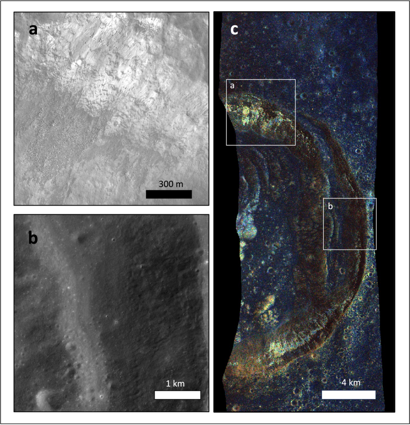
Images that show how areas of landslides and mass wasting (e.g., panel a) appear to ‘glow’ bright yellow in the radar data product (panel c) compared to surrounding areas without prominent mass wasting (e.g., panel b). (Photo provided by S. L. Pérez-Cortés. Data Source: NASA Lunar Reconnaissance Orbiter mission)
That ability could matter for future exploration. NASA's Artemis missions are targeting the lunar south pole, where lighting is challenging. Despite the perpetual darkness, permanently shadowed regions may preserve important science targets and are the most likely candidates to host ice. Radar products like the ones used in this study could help scientists and mission planners better understand unstable terrain, slope hazards and surface conditions before robotic or human missions arrive.
For Pérez-Cortés, the work is part of a larger effort to understand how planetary surfaces change over time. Her research uses spacecraft images, radar observations, topography and other remote sensing data to study mass wasting, impact cratering and tectonic activity on rocky and icy worlds throughout our Solar System.
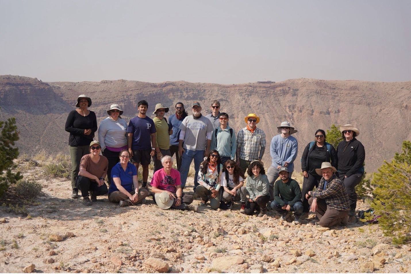
Mini-RF team in Meteor Crater, Arizona. May 2025. Purdue doctoral candidate S. L. Pérez-Cortés is third from right in the bottom row. (Photo provided by the Mini-RF Team)
Led by Purdue researchers Pérez-Cortés and Bramson, the project was part of a broader collaboration across planetary science, radar science and NASA mission teams. Edgard G. Rivera-Valentín of Johns Hopkins University Applied Physics Laboratory co-developed the radar analysis methodology, provided mentorship in radar remote sensing and contributed significantly to the interpretation of the Mini-RF observations. Wes Patterson, principal investigator of the Mini-RF instrument at Johns Hopkins University Applied Physics Laboratory, provided expertise in radar science and helped guide the interpretation of the data. Cole A. Nypaver of the Smithsonian Institution's Center for Earth and Planetary Studies contributed to the interpretation of the radar data. Anne K. Virkki of the University of Helsinki and Patrick A. Taylor of the National Radio Astronomy Observatory contributed expertise in radar scattering and polarimetric radar interpretation. Robert Melikyan of the University of Arizona assisted with the early visualization and interpretation of the radar data.
This research was supported by the National Science Foundation (NSF) Graduate Research Fellowship Program (GRFP), which funded Pérez-Cortés' doctoral research under grant No. 1842166. The study used data from NASA's Lunar Reconnaissance Orbiter mission, including observations from the Mini-RF instrument. Support for Bramson and portions of the Mini-RF science team was provided by NASA to the Lunar Reconnaissance Orbiter project under contract No. NNN16AA05T.
About the Department of Earth, Atmospheric, and Planetary Sciences at Purdue University
The Department of Earth, Atmospheric, and Planetary Sciences (EAPS) combines four of Purdue’s most interdisciplinary programs: geology and geophysics, environmental sciences, atmospheric sciences, and planetary sciences. EAPS conducts world-class research; educates undergraduate and graduate students; and provides our college, university, state and country with the information necessary to understand the world and universe around us. Our research is globally recognized; our students are highly valued by graduate schools and employers; and our alumni continue to make significant contributions in academia, industry, and federal and state government.
Written by: David Siple, communications specialist, Department of Earth, Atmospheric, and Planetary Sciences at Purdue University