Purdue researchers uncover deep mantle process that reshaped the North American midcontinent
04-22-2026
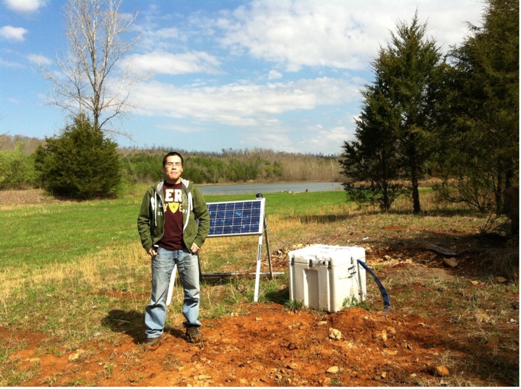
Xiaotao Yang at one of the OIINK seismic stations used in this study. Photo taken in 2012 during the field work to deploy the seismic station. (Picture provided by/Xiaotao Yang)
A hidden rupture deep beneath North America may have reshaped the landscape of the central United States hundreds of millions of years ago. New research led by Purdue University found that a dense part of the continent's deep rocky foundation likely peeled away and sank into the mantle, allowing hotter, lighter material to rise and lift the land above it. That uplift may explain why the Illinois and Michigan basins, which had been slowly sinking for hundreds of millions of years, abruptly stopped subsiding.
The discovery, led by Xiaotao Yang, assistant professor in Purdue's Department of Earth, Atmospheric, and Planetary Sciences, was published in AGU Advances. Yang led the project and carried out the seismic imaging processing, formal analysis, interpretation and integration of the results.
At the center of the study is a long-standing geologic mystery. Cratonic basins are broad depressions inside the oldest and most stable parts of continents. They usually sink very slowly over immense spans of time as sediments accumulate. But the Illinois and Michigan basins did not simply level off. Instead, the geologic record suggested something more dramatic had happened.
"We found that a deep part of North America's 'rocky foundation' broke off millions of years ago, and that event changed how the land above it behaved," Yang said. "Normally, large basins within relatively stable continental interiors, called cratonic basins, such as the Illinois and Michigan Basins, slowly sink over hundreds of millions of years as sediments pile up. But in this case, we discovered that the sinking suddenly stopped because a dense layer deep beneath the continent peeled away and sank into the Earth's mantle, a process called lithospheric delamination."
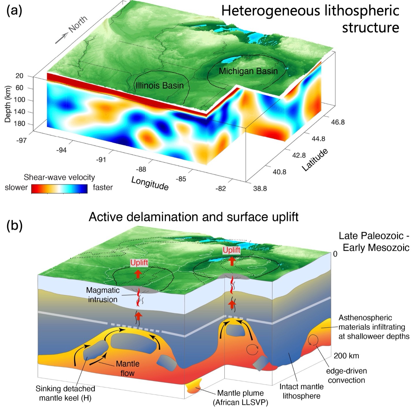
Caption: (a) Seismic shear-wave velocity structure below the North American midcontinent reveals strong structural heterogeneities, with scattered low-velocity volumes within the mantle lithosphere beneath major surface tectonic features. (b) Combining the seismic structural constraints with geological and geodynamic modeling results, this work proposes lithospheric delamination as the mechanism driving the termination of subsidence in the intracratonic Illinois and Michigan Basins. (Figure provided by/Xiaotao Yang)
To investigate that deep structure, the team used full-wave ambient noise tomography, a seismic imaging method that works much like a CT scan for the Earth. In the paper, the researchers reported distinct low-velocity zones below about 60 kilometers beneath the Illinois and Michigan basins. Because seismic waves travel more slowly through hotter, softer material, those regions point to asthenospheric material that rose upward after older lithosphere foundered and sank away. The team's geodynamic models showed that this replacement by buoyant mantle material could have lifted the surface by about 3.5 kilometers, enough to halt subsidence and strip away some of the upper rock layers.
"Using seismic waves--much like medical imaging for the Earth--we can take a snapshot of the present-day internal structure of the Earth," Yang said. "We were able to see evidence of this process still preserved deep underground today.”
The findings matter beyond reconstructing an ancient geologic event. Cratonic basins host major groundwater systems and important mineral resources, and understanding why they stopped sinking can sharpen models of basin development, erosion and preservation of sedimentary layers. That can improve the geological interpretations used in energy exploration and in water and mineral resource assessment.
More broadly, the study connects deep Earth dynamics to the landscapes people see at the surface. "In simple terms, a hidden process far beneath the surface caused the ground to rise, stopping these ancient basins from sinking any further and reshaping the landscape of the central United States," Yang said.
Yang, who co-leads the Computational Seismology and Tectonic laboratory at Purdue, said the study depended on major computing power as well as collaboration across institutions. Purdue's research computing clusters made it possible to process large seismic data sets and run complex simulations with computational resources from Purdue's Rosen Center for Advanced Computing.
This work was supported by Purdue University startup funding and National Science Foundation award EAR-2319445 to Yang, along with the Lee J. Suttner Professorship at Indiana University for Stevens Goddard. Seismic waveform data were accessed through the NSF SAGE data archive operated by EarthScope Consortium under NSF award 1724509.
About the Department of Earth, Atmospheric, and Planetary Sciences at Purdue University
The Department of Earth, Atmospheric, and Planetary Sciences (EAPS) combines four of Purdue’s most interdisciplinary programs: geology and geophysics, environmental sciences, atmospheric sciences, and planetary sciences. EAPS conducts world-class research; educates undergraduate and graduate students; and provides our college, university, state and country with the information necessary to understand the world and universe around us. Our research is globally recognized; our students are highly valued by graduate schools and employers; and our alumni continue to make significant contributions in academia, industry, and federal and state government.
About the Rosen Center for Advanced Computing
The Rosen Center for Advanced Computing operates the centrally-maintained research computing resources at Purdue University, providing access to leading-edge computational and data storage systems as well as expertise and support to Purdue faculty, staff, and student researchers. The center also operates the Anvil supercomputer, an NSF-funded national HPC resource that provides advanced computing capabilities to researchers nationwide through the NSF’s ACCESS and NAIRR Pilot programs.
Written by: David Siple, communications specialist, Department of Earth, Atmospheric, and Planetary Sciences at Purdue University