Ancient Desert Clues Reveal Rhythmic Climate Shifts in Early Pleistocene Death Valley
12-16-2025
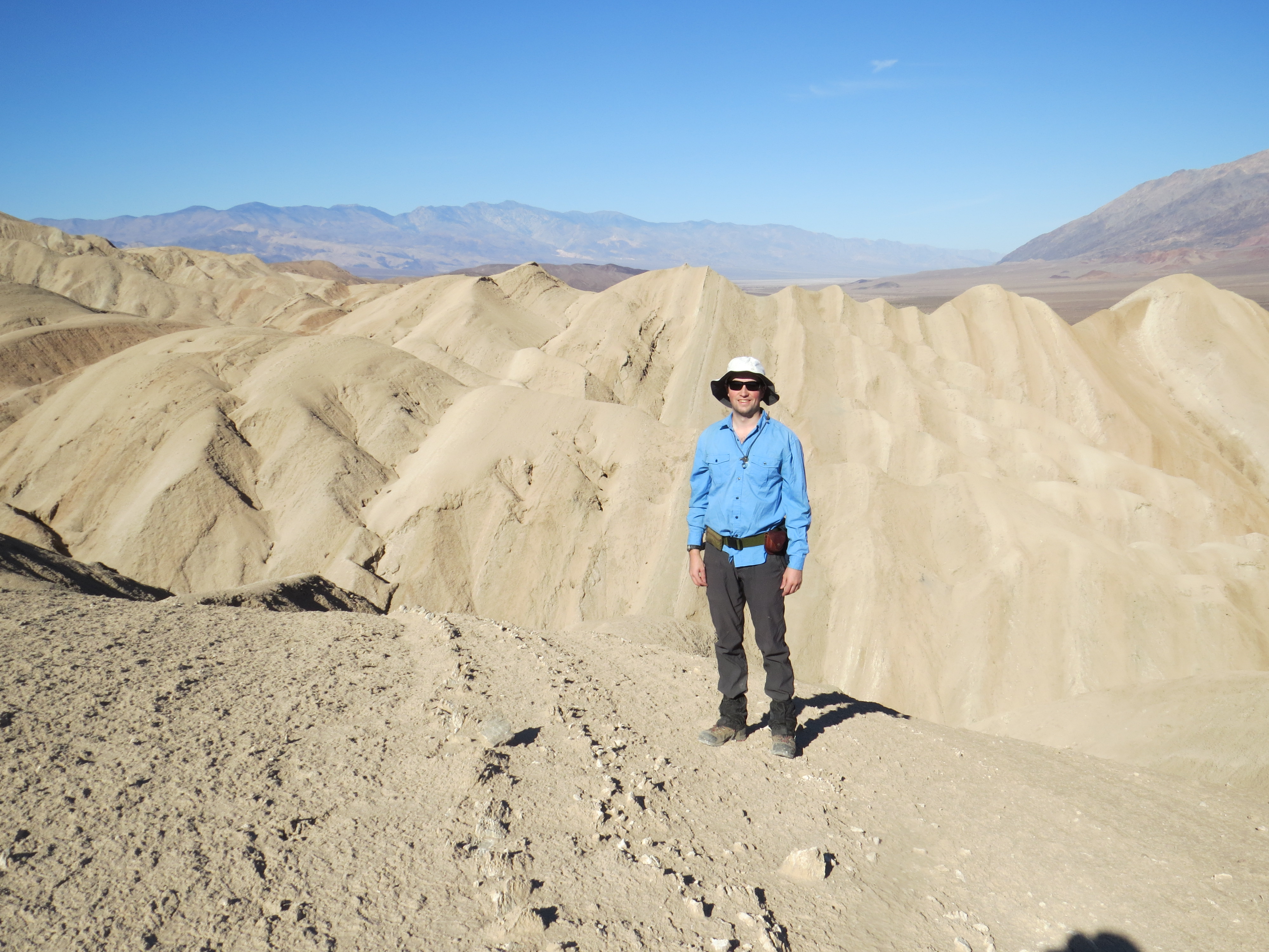
Brandon Keough conducting field work in the Confidence Hills region of southern Death Valley. Each of the small ridges in the mid-ground are anhydrite beds that were deposited during the driest parts of precipitation cycles identified through this work. Conditions during these times were comparable to the driest conditions observed on Earth today in places like the Atacama Desert, Chile. (Photo credit: Ken Ridgway).
A new paleoclimate study from Purdue University has uncovered evidence that yearly precipitation in southern Death Valley once swung between extreme drought and significantly wetter than modern conditions over cycles lasting tens of thousands of years. The work reveals that about 2 million years ago, the area shifted between some of the driest conditions found anywhere on Earth today and conditions that supported expanded saline lakes. The duration of these aridity cycles matches global climate cycles during which continental ice sheets in the Northern Hemisphere advanced and retreated. Understanding these ancient cycles offers a window into how modern deserts could respond in the future as global temperatures continue to rise.
“Our work identified cyclic precipitation trends in Death Valley that were likely driven by these glacial-interglacial cycles,” said Brandon Keough, PhD candidate in the Department of Earth, Atmospheric and Planetary Sciences (EAPS). “The precipitation cycles identified through this study show that the Death Valley region experienced conditions ranging from similar to the driest places on Earth today (e.g., Atacama Desert, Chile) to considerably wetter than modern conditions over ~40,000-year intervals.”
This research, led by Keough and published in Palaeogeography, Palaeoclimatology, Palaeoecology, used geologic mapping, sedimentary records and a new geochemical technique developed at Purdue to reconstruct ancient precipitation in the Confidence Hills Formation. This collaborative approach allowed the team to not only track precipitation trends, but also to understand how the landscape evolved with changes in precipitation.
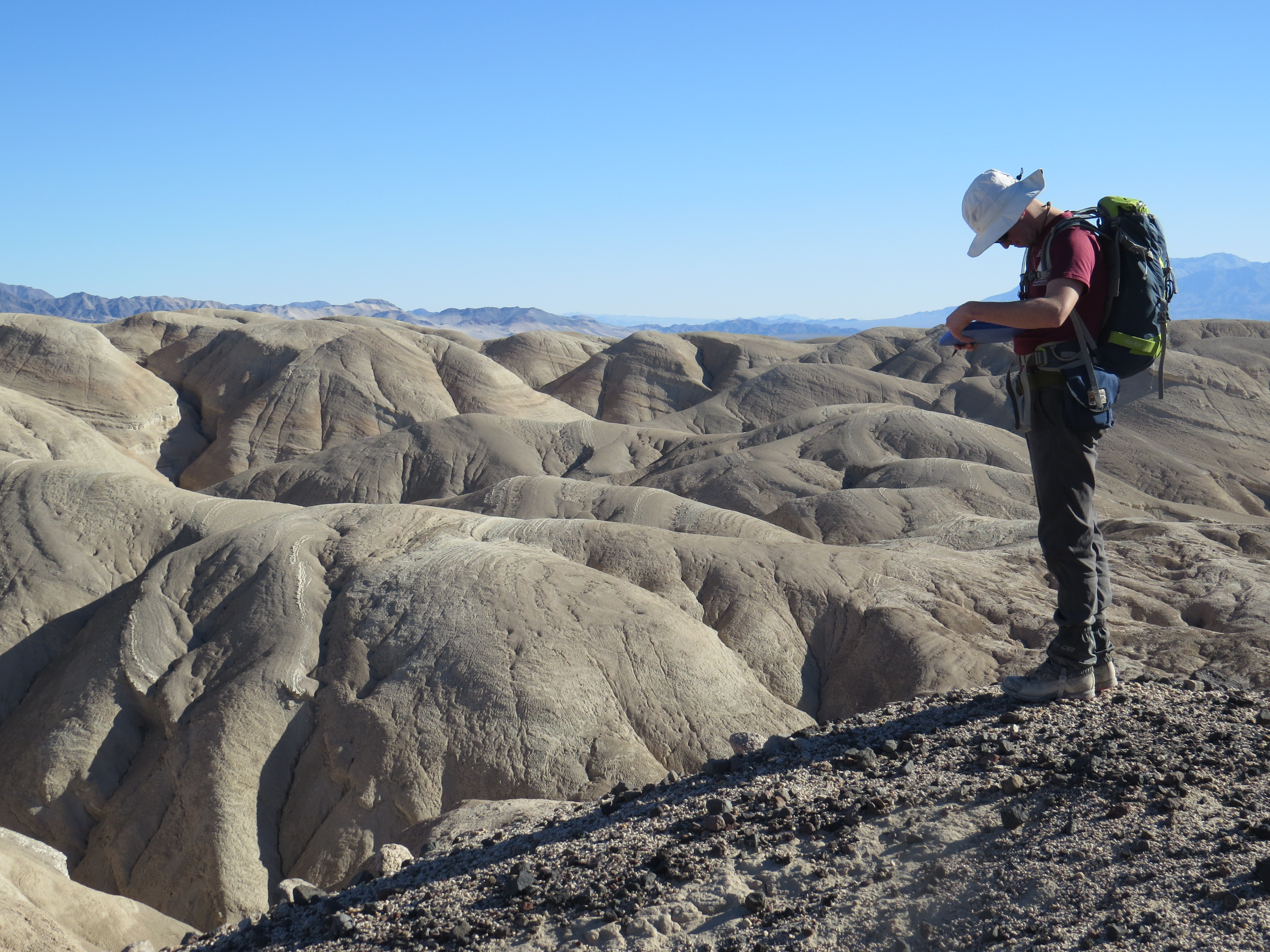
Conducting geologic mapping in the Confidence Hills to determine stratigraphic relationships used to understand cyclic depositional and precipitation trends in the early Pleistocene. (Brandon Keough shown – photo credit: Ken Ridgway).
The Purdue team included co-authors Dr. Greg Michalski, professor with a joint appointment in EAPS and Chemistry; Dr. Ken Ridgway, EAPS professor; undergraduate researchers Adriana Brown and Chris Buntin; and Purdue alumna and collaborator Dr. Fan Wang, now an associate professor at Sun Yat-Sen University in China.
Michalski and Ridgway wrote the National Science Foundation proposal that funded the research. Keough, Ridgway, and Michalski conducted collaborative fieldwork using sedimentary features to guide sample collection. Michalski also produced the lab-based geochemical data. Keough produced an updated geologic map, synthesized field and lab-based data and served as the primary manuscript author. Brown and Buntin contributed undergraduate research analyzing the samples, and Brown later presented the research at the American Geophysical Union Fall Meeting. Wang supported data synthesis and manuscript editing.
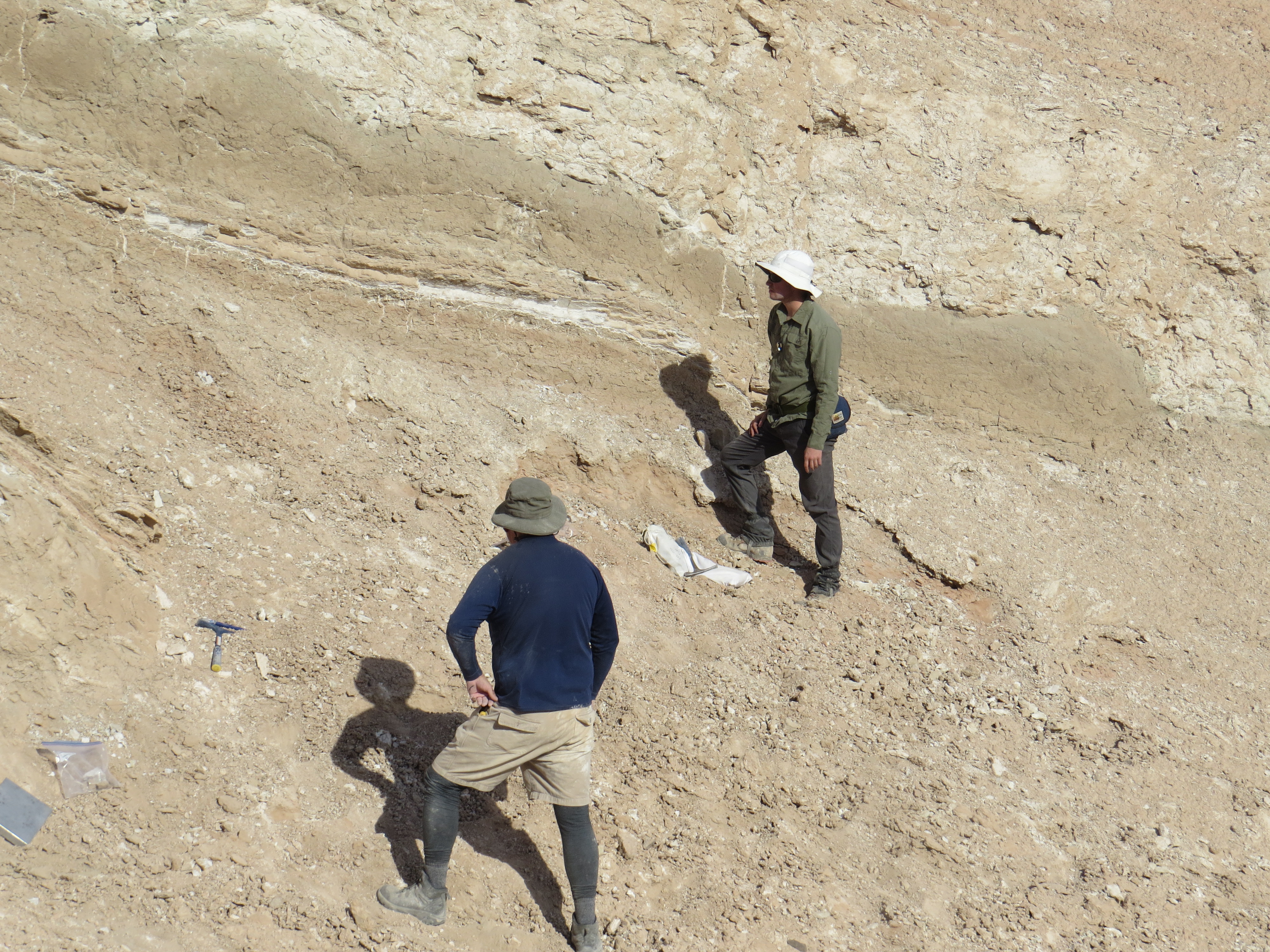
Professor Greg Michalski and PhD Candidate Brandon Keough describing an ancient soil horizon (paleosol). Nitrate samples from these deposits were analyzed at the Purdue Stable Isotope Geochemistry Lab to quantify mean annual precipitation in the early Pleistocene. (Photo credit: Ken Ridgway).
The method at the center of the publication uses the oxygen isotopic signature of ancient nitrate to calculate mean annual precipitation. Michalski and Wang originally developed and calibrated the proxy in modern desert systems. This new study is the first to validate it in ancient strata.
To ground the geochemical findings, Keough and Ridgway mapped and analyzed sedimentary layers that record lake expansion and contraction over time. Those layers revealed repeating cycles roughly 10 to 15 meters thick. Each reflected the drying and refilling of an ancient playa system that once filled southern Death Valley, similar to the modern Badwater Basin. At 282 feet below sea level, the Badwater Basin is one of the driest locations in North America today and formed from the desiccation of a formerly extensive saline lake, Lake Manly.
“Our work produces a record of changes to surface environments in response to precipitation trends over local-regional scales,” said Keough. “These are the same scales at which humans experience climate change, meaning that our results are pertinent to understanding how environmental change impacts the environments in which we live.”
These findings may also have economic implications. The types of evaporitic lake systems examined in this study are known to host significant lithium deposits. Understanding how and when such systems develop may help inform future resource exploration as global lithium demand increases alongside electrification and battery storage technologies.
The work represents a collaboration across multiple Purdue laboratories, including the Purdue Basin Analysis Lab and the EAPS Stable Isotope Geochemistry Lab. The project draws on strengths in field geology, isotope geochemistry and sedimentology.
“Our team within EAPS represents an inter-disciplinary group that was well suited to tackle this issue,” Keough said. For Keough, uncovering these long-term records offers a broader lesson as modern climate systems accelerate beyond natural rhythms.
“Understanding geologically recent drivers of precipitation trends in the North American southwest has implications for predicting future conditions that may result from changes to the climate system,” he said.
This research was funded by NSF grant AGS-190646 awarded to Michalski and Ridgway. Additional support was provided by the Purdue Climate Change Research Center and the James and Susan Cearley Basin Analysis Fund.
About the Department of Earth, Atmospheric, and Planetary Sciences at Purdue University
The Department of Earth, Atmospheric, and Planetary Sciences (EAPS) combines four of Purdue’s most interdisciplinary programs: geology and geophysics, environmental sciences, atmospheric sciences, and planetary sciences. EAPS conducts world-class research; educates undergraduate and graduate students; and provides our college, university, state and country with the information necessary to understand the world and universe around us. Our research is globally recognized; our students are highly valued by graduate schools and employers; and our alumni continue to make significant contributions in academia, industry, and federal and state government.
Written by: David Siple, communications specialist, Department of Earth, Atmospheric, and Planetary Sciences at Purdue University
Contributors: Brandon Keough, PhD candidate in the Department of Earth, Atmospheric and Planetary Sciences (EAPS)